Cafe nearby Dapur 0 km
Indonesia
Cafe nearby Dapur 0 km
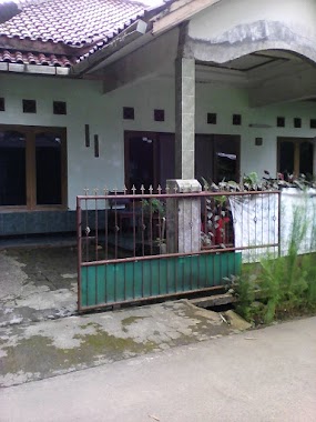
Dapur 0 km
36, Jalan Raya Sirkuit Sentul, 16810, Bogor, Jawa Barat, ID Indonesia
contacts phone
:
+62
Latitude:
-6.531057
, Longitude:
106.854281
larger map & directions
read more
nearest Cafe
7 m
Cafe Nol Km
Jalan Raya Sirkuit Sentul No.18, Sentul
Cafe
read more
157 m
Kedai Nyosoe
Sentul
Cafe
read more
356 m
Ikho-Hoki Juice & Sop Buah
Jalan Raya Sirkuit Sentul, Sentul
Cafe
read more
368 m
Martabak Bandung
Jalan Sentul International Circuit
Cafe
read more
377 m
Kedai Makanan Neng Icha
Jalan Raya Sirkuit Sentul, Sentul
Cafe
read more
425 m
Sotangbro
Jl. Raya Sirkuit Sentul No.20, Sentul, Babakan Madang, Sentul
Cafe
read more
526 m
Mabes AXP Bordep
Jalan Alternatif Sentul, Sentul
Cafe
read more
533 m
Mabes Axport Bordep
Jalan Alternatif Sentul, Sentul
Cafe
read more
539 m
warkop teras
Jalan Alternatif Sentul No.8-9, Sentul
Cafe
read more
767 m
Warkop Mang Janggot
Jalan Raya Sirkuit Sentul No.45-46, Kadumangu
Cafe
read more
873 m
Warkop Bang Gocir
Jalan Raya Sirkuit Sentul No.70g, Sentul
Cafe
read more
873 m
Warkop Bang Gocir
Indonesia
Cafe
read more
873 m
Warkop Bang Gocir
Sentul
Cafe
read more
992 m
All In Street Food
Jalan Raya Sirkuit Sentul No.464, Sentul
Cafe
read more
1.007 km
Roti Bakar All In
Jalan Pahlawan No.464, Leuwinutug
Cafe
read more
1.044 km
steam serra
Leuwinutug
Cafe
read more
1.087 km
Mie Ayam Blok M
Jalan Alternatif Sentul, Sentul
Cafe
read more
1.087 km
Saung Mahesa
Jalan Alternatif Sentul, Sentul
Cafe
read more
1.678 km
Unyu Unyu Cafe
Jalan Tangkil - Agrabinta, Tangkil
Cafe
read more
2.113 km
Warmindo Sarma / Karna
Jalan Pahlawan, Leuwinutug
Cafe
read more
2.181 km
Warkop Ki Bachrom
Jalan Anyar, Leuwinutug
Cafe
read more
2.236 km
Warung Kopi Nafisya
Jalan Pahlawan, Leuwinutug
Cafe
read more
2.251 km
Warung GO-SETAPAK
Jalan Alternatif Sentul, Nanggewer
Cafe
read more
2.413 km
Warung Teh Epen (W.T.E)
Jalan Bougenville Raya No.11, Pasirlaya
Cafe
read more
2.472 km
Joyce Marylean Ch. L. Tobing
Blok K No.12,, Jalan Alamanda Raya, Pasirlaya
Cafe
read more
📑
all categories
Accounting
Administrative area level 1
Administrative area level 2
Airport
Amusement park
Aquarium
Art gallery
Atm
Bakery
Bank
Bar
Beauty salon
Bicycle store
Book store
Bowling alley
Bus station
Cafe
Campground
Car dealer
Car rental
Car repair
Car wash
Casino
Cemetery
Church
City hall
Clothing store
Colloquial area
Convenience store
Courthouse
Dentist
Department store
Doctor
Electrician
Electronics store
Embassy
Finance
Fire station
Florist
Food
Funeral home
Furniture store
Gas station
General contractor
Grocery or supermarket
Gym
Hair care
Hardware store
Health
Hindu Temple
Home goods store
Hospital
Insurance agency
Intersection
Jewelry store
Laundry
Lawyer
Library
Liquor store
Local government office
Locality
Locksmith
Lodging
Meal delivery
Meal takeaway
Mosque
Movie rental
Movie theater
Moving company
Museum
Natural feature
Neighborhood
Night club
Painter
Park
Parking
Pet store
Pharmacy
Physiotherapist
Place of worship
Plumber
Point of interest
Police
Political
Post office
Premise
Real estate agency
Restaurant
Roofing contractor
Route
Rv park, camping
School
Shoe store
Shopping mall
Spa
Stadium
Storage
Store
Subpremise
Supermarket
Synagogue
Taxi stand
Train station
Transit station
Travel agency
University
Veterinary care
Zoo
administrative area level 3
administrative area level 4
administrative area level 5
sublocality level 1
↑