Cafe nearby Cappucino Cincau
Indonesia
Cafe nearby Cappucino Cincau
Cappucino Cincau
2, Jalan Wibawa Mukti II, 17426, Kota Bekasi, Jawa Barat, ID Indonesia
contacts phone
:
+62 813-9816-3060
Latitude:
-6.3521056
, Longitude:
106.9384889
larger map & directions
read more
nearest Cafe
157 m
Warung Kopi Bean
Jatirangga
Cafe
read more
161 m
Japa Juice
Jatirangga
Cafe
read more
193 m
Sate AYAM PONOROGO
Jalan Raya Kranggan Wetan No.43, Jatirangga
Cafe
read more
199 m
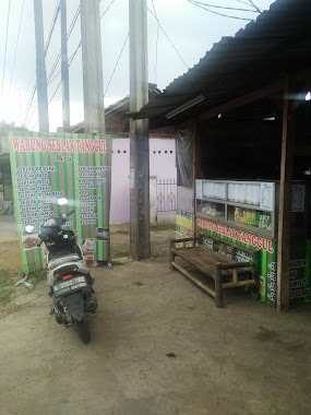
Warung Seblak Tanggul
Jatisari
Cafe
read more
199 m
Gubug Diman
Jatisari
Cafe
read more
222 m
RUTAN
Jalan Raya Kranggan Wetan No.45, Jatirangga
Cafe
read more
238 m
Warung Kane
Jalan Wibawa Mukti II, Jatiluhur
Cafe
read more
309 m
Angkringan GNX_GROUP
Jalan Raya Kranggan Wetan, Jatirangga
Cafe
read more
320 m
Tahu Pedas Jeletot
Jalan Raya Mess Al No.10, Jatisari
Cafe
read more
534 m
Michelle Taiwan Snack
Jalan Mes Al/Rambutan No.50, Jatirangga
Cafe
read more
535 m
Wr Mang Ujang
Jalan Rambutan, Jatirangga
Cafe
read more
571 m
Dunia Ceria
Jalan Mendut No.11, Jatisari
Cafe
read more
593 m
warkop dian
Jalan Ili 2 No.40-26, Jatirangga
Cafe
read more
649 m
Cafe Bule
Jalan Raya Kranggan Wetan No.20, Jatirangga
Cafe
read more
693 m
Kafe Bang Doel
Jalan Raya Kranggan Wetan No.4, Jatirangga
Cafe
read more
756 m
Warbud Gelvans
Jatisari
Cafe
read more
761 m
Warung MociTansu Laka Laka Teh Poci & Ketan Susu
JL Wibawa Mukti II, Pasar AURI Bumi Dirgantara Permai, seberang Patung Kuda, Cakung Payangan, Jatisari
Cafe
read more
807 m
Warung Aliya LUsi Elsia
Jalan Raya AL, Jatirangga
Cafe
read more
821 m
Joglo ili - dapur jeng Retno
Jatirangga
Cafe
read more
831 m
Wedang Ronde
Jalan Raya Mess Al, Jatisari
Cafe
read more
834 m
Rujak Legi - Ukeg
Gang Mandor No.2, Jatisari
Cafe
read more
873 m
Destino View Cafe
Jatiraden
Cafe
read more
928 m
Cendol Kavling Pati
Gang Mandor No.2, Jatisari
Cafe
read more
955 m
Warung Kopi BALAKASONO
Jalan Raya AL, Jatirangga
Cafe
read more
998 m
Rarez Home Base
Wahana C4 No.11, Jatiranggon
Cafe
read more
📑
all categories
Accounting
Administrative area level 1
Administrative area level 2
Airport
Amusement park
Aquarium
Art gallery
Atm
Bakery
Bank
Bar
Beauty salon
Bicycle store
Book store
Bowling alley
Bus station
Cafe
Campground
Car dealer
Car rental
Car repair
Car wash
Casino
Cemetery
Church
City hall
Clothing store
Colloquial area
Convenience store
Courthouse
Dentist
Department store
Doctor
Electrician
Electronics store
Embassy
Finance
Fire station
Florist
Food
Funeral home
Furniture store
Gas station
General contractor
Grocery or supermarket
Gym
Hair care
Hardware store
Health
Hindu Temple
Home goods store
Hospital
Insurance agency
Intersection
Jewelry store
Laundry
Lawyer
Library
Liquor store
Local government office
Locality
Locksmith
Lodging
Meal delivery
Meal takeaway
Mosque
Movie rental
Movie theater
Moving company
Museum
Natural feature
Neighborhood
Night club
Painter
Park
Parking
Pet store
Pharmacy
Physiotherapist
Place of worship
Plumber
Point of interest
Police
Political
Post office
Premise
Real estate agency
Restaurant
Roofing contractor
Route
Rv park, camping
School
Shoe store
Shopping mall
Spa
Stadium
Storage
Store
Subpremise
Supermarket
Synagogue
Taxi stand
Train station
Transit station
Travel agency
University
Veterinary care
Zoo
administrative area level 3
administrative area level 4
administrative area level 5
sublocality level 1
↑