Cafe nearby cafe gondrong
Indonesia
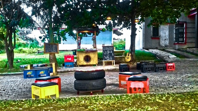
Cafe nearby cafe gondrong
cafe gondrong
Sukahati, Citeureup, Bogor, West Java 16810, Indonesia
contacts phone
:
+62
Latitude:
-6.5140989
, Longitude:
106.8775427
larger map & directions
read more
nearest Cafe
10 m
coffe +- (plus minus)
pondok citeureup indah, Sukahati
Cafe
read more
85 m
Kedai Mas Pedro.
Jalan Elang No.7, Sukahati
Cafe
read more
478 m
Cafe Cimot
Jalan Kampung Sangkali No.2, Sukahati
Cafe
read more
480 m
CAFFE ZAQQI
Kp. Sangkali, Jalan Pangeran Samiaji Kampung Nagrog, Sukahati
Cafe
read more
490 m
Cafe Icih
Jalan Kampung Sangkali No.10, Sukahati
Cafe
read more
581 m
Warung Nenek
Unnamed Road, 16810, Sanja
Cafe
read more
693 m
Warkop Cepy
Unnamed Road, Sukahati
Cafe
read more
998 m
Kedai Es Kelapa Muda Puja
Jalan Anyar, Tangkil
Cafe
read more
1.007 km
Bukit Saung Pleci
RT-02, 08, Sukahati
Cafe
read more
1.008 km
Jual Es Camelo
Jl. Pangeran Samiaji Kp. Nagrog no.34 RT 05/02,, Sukahati
Cafe
read more
1.223 km
Warkop Ki Bachrom
Jalan Anyar, Leuwinutug
Cafe
read more
1.412 km
Warung Kopi Net
Jalan Pahlawan, Sanja
Cafe
read more
1.443 km
Sanja Warkop Moy
Jalan Pahlawan, Sanja
Cafe
read more
1.464 km
Naj Cafe
JL Pahlawan, RT 4 RW 4, No. 57, Sanja, Citeureup, Sanja
Cafe
read more
1.472 km
Bewok's Cafe
Sanja
Cafe
read more
1.527 km
Warung Kopi Nafisya
Jalan Pahlawan, Leuwinutug
Cafe
read more
1.532 km
Sotang Bro
Jalan Tengsaw No.18, Tarikolot
Cafe
read more
1.573 km
Warmindo Sarma / Karna
Jalan Pahlawan, Leuwinutug
Cafe
read more
1.715 km
Rumah Kopi Purbayan
Jalan Branta Mulia, Karang Asem Timur
Cafe
read more
1.886 km
Warmindo Pancarasa
Jalan Pahlawan, Karang Asem Barat
Cafe
read more
1.91 km
Raffi By Naufal
Tarikolot
Cafe
read more
1.973 km
Oef Corner
Jalan Raya Sirkuit Sentul No.21, Leuwinutug
Cafe
read more
1.996 km
Waroeng Bujang
Jalan Tengsaw No.53-52, Tarikolot
Cafe
read more
2.001 km
Unyu Unyu Cafe
Jalan Tangkil - Agrabinta, Tangkil
Cafe
read more
2.01 km
Warkop GOJEK 24 Jam
Jalan Tangkil - Agrabinta No.28, Leuwinutug
Cafe
read more
📑
all categories
Accounting
Administrative area level 1
Administrative area level 2
Airport
Amusement park
Aquarium
Art gallery
Atm
Bakery
Bank
Bar
Beauty salon
Bicycle store
Book store
Bowling alley
Bus station
Cafe
Campground
Car dealer
Car rental
Car repair
Car wash
Casino
Cemetery
Church
City hall
Clothing store
Colloquial area
Convenience store
Courthouse
Dentist
Department store
Doctor
Electrician
Electronics store
Embassy
Finance
Fire station
Florist
Food
Funeral home
Furniture store
Gas station
General contractor
Grocery or supermarket
Gym
Hair care
Hardware store
Health
Hindu Temple
Home goods store
Hospital
Insurance agency
Intersection
Jewelry store
Laundry
Lawyer
Library
Liquor store
Local government office
Locality
Locksmith
Lodging
Meal delivery
Meal takeaway
Mosque
Movie rental
Movie theater
Moving company
Museum
Natural feature
Neighborhood
Night club
Painter
Park
Parking
Pet store
Pharmacy
Physiotherapist
Place of worship
Plumber
Point of interest
Police
Political
Post office
Premise
Real estate agency
Restaurant
Roofing contractor
Route
Rv park, camping
School
Shoe store
Shopping mall
Spa
Stadium
Storage
Store
Subpremise
Supermarket
Synagogue
Taxi stand
Train station
Transit station
Travel agency
University
Veterinary care
Zoo
administrative area level 3
administrative area level 4
administrative area level 5
sublocality level 1
↑