Bus station nearby Pos Polisi TMP Kalibata
Indonesia
Bus station nearby Pos Polisi TMP Kalibata
Pos Polisi TMP Kalibata
Indonesia Indonesia
contacts phone
:
+62
Latitude:
-6.255341
, Longitude:
106.843662
read more
nearest Bus station
43 m
Halte Tmp. Kalibata
Jalan Raya Kalibata RT.6/RW.7, Duren Tiga
Bus station
read more
56 m
Halte Makam Pahlawan
Jalan Kalibata Raya RT.14/RW.1, Kalibata
Bus station
read more
111 m
Opposite Graha Soksi
Indonesia
Bus station
read more
132 m
Graha Soksi
Indonesia
Bus station
read more
144 m
Halte Per Tani
Jalan Raya Pasar Minggu RT.5, Kalibata
Bus station
read more
311 m
Opposite Halte Masjid
Indonesia
Bus station
read more
314 m
Halte Masjid
Jalan Raya Pasar Minggu RT.7, Kalibata
Bus station
read more
368 m
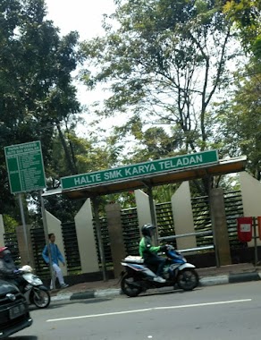
Halte Smk Karya Teladan
Jalan Raya Pasar Minggu RT.14, Kalibata
Bus station
read more
406 m
Levis Outlet Store Pancoran
Indonesia
Bus station
read more
589 m
Halte Perdatam
Jalan Raya Pasar Minggu RT.3/RW.1, Pancoran
Bus station
read more
622 m
Halte Minyak
RT.3/RW.6, Duren Tiga
Bus station
read more
627 m
Masjid Al-Munawar, Jl. Pasar Minggu
RT.1/RW.6, Pancoran
Bus station
read more
697 m
Halte Transmigrasi
Jalan Raya Kalibata RT.6/RW.7, Rawajati
Bus station
read more
711 m
Halte Pomad
Jalan Raya Pasar Minggu RT.1/RW.6, Kalibata
Bus station
read more
721 m
Halte Pomad 1
Indonesia
Bus station
read more
769 m
Indomaret Duren Tiga Timur
Indonesia
Bus station
read more
815 m
One Optik
Indonesia
Bus station
read more
866 m
Beads & Ethnic Jewelry
Indonesia
Bus station
read more
883 m
Halte Empang 3
Jalan Raya Pasar Minggu RT.1/RW.4, Kalibata
Bus station
read more
902 m
Masjid Al - Hidayah Kalibata Timur
Indonesia
Bus station
read more
933 m
Panin Bank Pasar Minggu
Indonesia
Bus station
read more
969 m
Kalibata City Square
Indonesia
Bus station
read more
980 m
Kalibata Residence
Indonesia
Bus station
read more
984 m
Halte Pancoran
Jalan Raya Pasar Minggu RT.6/RW.2, Pancoran
Bus station
read more
1.184 km
TB Jaya
Indonesia
Bus station
read more
📑
all categories
Accounting
Administrative area level 1
Administrative area level 2
Airport
Amusement park
Aquarium
Art gallery
Atm
Bakery
Bank
Bar
Beauty salon
Bicycle store
Book store
Bowling alley
Bus station
Cafe
Campground
Car dealer
Car rental
Car repair
Car wash
Casino
Cemetery
Church
City hall
Clothing store
Colloquial area
Convenience store
Courthouse
Dentist
Department store
Doctor
Electrician
Electronics store
Embassy
Finance
Fire station
Florist
Food
Funeral home
Furniture store
Gas station
General contractor
Grocery or supermarket
Gym
Hair care
Hardware store
Health
Hindu Temple
Home goods store
Hospital
Insurance agency
Intersection
Jewelry store
Laundry
Lawyer
Library
Liquor store
Local government office
Locality
Locksmith
Lodging
Meal delivery
Meal takeaway
Mosque
Movie rental
Movie theater
Moving company
Museum
Natural feature
Neighborhood
Night club
Painter
Park
Parking
Pet store
Pharmacy
Physiotherapist
Place of worship
Plumber
Point of interest
Police
Political
Post office
Premise
Real estate agency
Restaurant
Roofing contractor
Route
Rv park, camping
School
Shoe store
Shopping mall
Spa
Stadium
Storage
Store
Subpremise
Supermarket
Synagogue
Taxi stand
Train station
Transit station
Travel agency
University
Veterinary care
Zoo
administrative area level 3
administrative area level 4
administrative area level 5
sublocality level 1
↑