Bus station nearby Halte Bus Carrefour
Indonesia
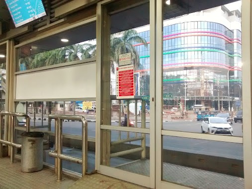
Bus station nearby Halte Bus Carrefour
Halte Bus Carrefour
Jalan A. YAni, 10640, Kota Jakarta Pusat, Daerah Khusus Ibukota Jakarta, ID Indonesia
contacts phone
:
+62
Latitude:
-6.1689636
, Longitude:
106.8776074
larger map & directions
read more
nearest Bus station
14 m
Halte Transmart
Indonesia
Bus station
read more
70 m
Taman Ria Rio
Indonesia
Bus station
read more
285 m
PT. Sempana Setia Sakti
Indonesia
Bus station
read more
289 m
Opposite ITC Cempaka Mas,Jl. Letnan Jenderal Suprato
RT.10/RW.7, Cempaka Putih Timur
Bus station
read more
326 m
Cempaka Timur
RW.8, Sumur Batu
Bus station
read more
338 m
Cempaka Mas
RW.8, Sumur Batu
Bus station
read more
397 m
Cempaka Mas
Jalan Jend. A. Yani, Kelapa Gading Barat
Bus station
read more
397 m
Cempaka Mas
Jalan Jendral Ahmad Yani, Kelapa Gading Barat
Bus station
read more
405 m
Halte Pasar
Jalan Perintis Kemerdekaan RT.2/RW.11, Kelapa Gading Barat
Bus station
read more
442 m
Halte Bpjs Kesehatan
Indonesia
Bus station
read more
480 m
Haltem Taman Cempaka Mas
Indonesia
Bus station
read more
556 m
Pedongkelan
RT.7/RW.2, Kelapa Gading Barat, Kelapa Gading
Bus station
read more
578 m
Opposite ITC Cempaka Mas
Indonesia
Bus station
read more
588 m
Halte Bus Sekolah Kalbe Farma
Indonesia
Bus station
read more
621 m
Halte Bus Sekolah
Jalan Perintis Kemerdekaan RT.7/RW.2, Kelapa Gading Barat
Bus station
read more
638 m
Halte Kalbe Farma
Indonesia
Bus station
read more
738 m
Pos Kali Sunter
Indonesia
Bus station
read more
793 m
Opposite Yamaha, Jl. Letnan Jenderal Suprato
RT.16/RW.5, Cempaka Baru
Bus station
read more
799 m
RS Islam
RT.16/RW.5, Cempaka Baru, Kemayoran
Bus station
read more
885 m
Halte Yos Sudarso Kodamar 1
Indonesia
Bus station
read more
906 m
Pulomas Bypass
RT.6/RW.11, Kayu Putih
Bus station
read more
946 m
Pulomas Pancuan Kuda
RT.8/RW.3, Cempaka Putih Timur
Bus station
read more
947 m
Halte Bus Sekolah
Jalan A. Yani RT.8/RW.3, Cempaka Putih Timur
Bus station
read more
950 m
Halte Up Perparkiran
Jalan Perintis Kemerdekaan RT.1/RW.15, Kayu Putih
Bus station
read more
1.119 km
Alfamar Sunter Jaya
Indonesia
Bus station
read more
📑
all categories
Accounting
Administrative area level 1
Administrative area level 2
Airport
Amusement park
Aquarium
Art gallery
Atm
Bakery
Bank
Bar
Beauty salon
Bicycle store
Book store
Bowling alley
Bus station
Cafe
Campground
Car dealer
Car rental
Car repair
Car wash
Casino
Cemetery
Church
City hall
Clothing store
Colloquial area
Convenience store
Courthouse
Dentist
Department store
Doctor
Electrician
Electronics store
Embassy
Finance
Fire station
Florist
Food
Funeral home
Furniture store
Gas station
General contractor
Grocery or supermarket
Gym
Hair care
Hardware store
Health
Hindu Temple
Home goods store
Hospital
Insurance agency
Intersection
Jewelry store
Laundry
Lawyer
Library
Liquor store
Local government office
Locality
Locksmith
Lodging
Meal delivery
Meal takeaway
Mosque
Movie rental
Movie theater
Moving company
Museum
Natural feature
Neighborhood
Night club
Painter
Park
Parking
Pet store
Pharmacy
Physiotherapist
Place of worship
Plumber
Point of interest
Police
Political
Post office
Premise
Real estate agency
Restaurant
Roofing contractor
Route
Rv park, camping
School
Shoe store
Shopping mall
Spa
Stadium
Storage
Store
Subpremise
Supermarket
Synagogue
Taxi stand
Train station
Transit station
Travel agency
University
Veterinary care
Zoo
administrative area level 3
administrative area level 4
administrative area level 5
sublocality level 1
↑