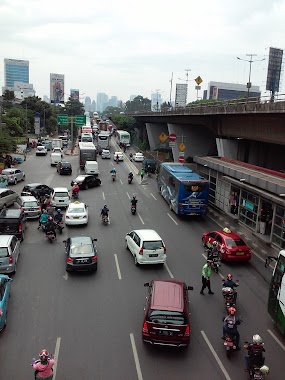
Bus station nearby Halte Badan Pemeriksa Keuangan
Coronavirus disease (COVID-19) Situation
confirmed cases
6829221
deaths
162063
Indonesia
Bus station nearby Halte Badan Pemeriksa Keuangan
Halte Badan Pemeriksa Keuangan
Indonesia Indonesia
contacts phone
:
+62
Latitude:
-6.206362
, Longitude:
106.802813
read more
nearest Bus station
89 m
Kantor Pos Manggala Wanabakti
Indonesia
Bus station
read more
270 m
Opposite Rumah Kaft Unsyiah Jabajab
Indonesia
Bus station
read more
299 m
Halte Pejompongan
Jalan Pejompongan Raya RT.1/RW.5, Bendungan Hilir
Bus station
read more
324 m
Rumah Makan Sinar Famili
Indonesia
Bus station
read more
355 m
Halte Komplek
Jalan Pejompongan Raya RT.4/RW.5, Bendungan Hilir
Bus station
read more
384 m
Jl. Pejompongan
RT.3/RW.6, Bendungan Hilir
Bus station
read more
387 m
Warteg Nabila
Indonesia
Bus station
read more
558 m
Jl. Gelora 1
RT.1/RW.3, Gelora, Tanah Abang
Bus station
read more
585 m
SPBU 34-10201
Indonesia
Bus station
read more
641 m
Opposite Aska Mandiri Stationary
Indonesia
Bus station
read more
646 m
Hajadi
Indonesia
Bus station
read more
712 m
Halte Alfamart Letjen S. Parman
Indonesia
Bus station
read more
739 m
Halte Sekolah Laboratorium Medika Prima
Indonesia
Bus station
read more
739 m
Halte Rumah Sakit
Jalan Ks. Tubun RT.10/RW.6, Petamburan
Bus station
read more
750 m
Halte Slipi
Jalan Ks. Tubun RT.9/RW.5, Slipi
Bus station
read more
750 m
Rumah Sakit Bhakti Mulya, Jl. Aipda KS Tubun
RT.9/RW.5, Slipi
Bus station
read more
753 m
Rumah Sakit Bhakti Mulia
Indonesia
Bus station
read more
794 m
Halte Taman
Jalan Bendungan Hilir Raya RT.12/RW.6, Bendungan Hilir
Bus station
read more
817 m
Halte Lapangan Panah
Indonesia
Bus station
read more
903 m
Halte TPU
Jalan Ks. Tubun RT.1/RW.6, Petamburan
Bus station
read more
962 m
Halte Graha
Jalan Gerbang Pemuda No.1, Gelora
Bus station
read more
979 m
Halte Stadion Hal Basket
Indonesia
Bus station
read more
1.031 km
Halte PU Irigasi
Jalan Penjernihan 1 No.19, RT.10/RW.6, Bendungan Hilir
Bus station
read more
1.037 km
Senayan JCC
RT.1/RW.3, Gelora
Bus station
read more
1.057 km
Toko Mumtaaz
Indonesia
Bus station
read more
📑
all categories
Accounting
Administrative area level 1
Administrative area level 2
Airport
Amusement park
Aquarium
Art gallery
Atm
Bakery
Bank
Bar
Beauty salon
Bicycle store
Book store
Bowling alley
Bus station
Cafe
Campground
Car dealer
Car rental
Car repair
Car wash
Casino
Cemetery
Church
City hall
Clothing store
Colloquial area
Convenience store
Courthouse
Dentist
Department store
Doctor
Electrician
Electronics store
Embassy
Finance
Fire station
Florist
Food
Funeral home
Furniture store
Gas station
General contractor
Grocery or supermarket
Gym
Hair care
Hardware store
Health
Hindu Temple
Home goods store
Hospital
Insurance agency
Intersection
Jewelry store
Laundry
Lawyer
Library
Liquor store
Local government office
Locality
Locksmith
Lodging
Meal delivery
Meal takeaway
Mosque
Movie rental
Movie theater
Moving company
Museum
Natural feature
Neighborhood
Night club
Painter
Park
Parking
Pet store
Pharmacy
Physiotherapist
Place of worship
Plumber
Point of interest
Police
Political
Post office
Premise
Real estate agency
Restaurant
Roofing contractor
Route
Rv park, camping
School
Shoe store
Shopping mall
Spa
Stadium
Storage
Store
Subpremise
Supermarket
Synagogue
Taxi stand
Train station
Transit station
Travel agency
University
Veterinary care
Zoo
administrative area level 3
administrative area level 4
administrative area level 5
sublocality level 1
↑