Bus station nearby Gedung PPEI, Jl. Tanjung Duren Raya
Indonesia
Bus station nearby Gedung PPEI, Jl. Tanjung Duren Raya
Gedung PPEI, Jl. Tanjung Duren Raya
RT.3/RW.8, Tomang, Grogol petamburan, Kota Jakarta Barat, Daerah Khusus Ibukota Jakarta 11440, Indonesia
contacts phone
:
+62
Latitude:
-6.17315
, Longitude:
106.79051
larger map & directions
read more
nearest Bus station
7 m
Halte Gerbang Tol
Indonesia
Bus station
read more
112 m
Soho Capital
Indonesia
Bus station
read more
170 m
Grand Tropic Suites Hotel
Indonesia
Bus station
read more
226 m
Halte Kampus Ukrida
Indonesia
Bus station
read more
264 m
Family Mart 2
Indonesia
Bus station
read more
424 m
PT. Health Wealth International
Indonesia
Bus station
read more
426 m
Universitas Tarumanagara Kampus I
Indonesia
Bus station
read more
427 m
Kostella Tanjung Duren
Indonesia
Bus station
read more
475 m
Ice Hill
Indonesia
Bus station
read more
500 m
Halte Universitas Tarumanagara
RT.12/RW.2, Tanjung Duren Utara
Bus station
read more
692 m
Tasya
Indonesia
Bus station
read more
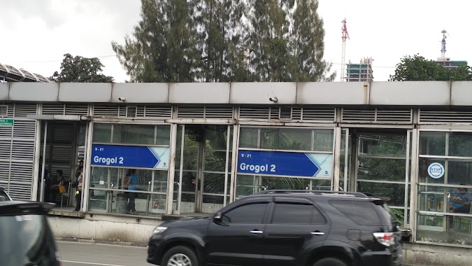
701 m
Grogol 2
Indonesia
Bus station
read more
706 m
Opposite PT. Atap Roofing Specialities
Indonesia
Bus station
read more
717 m
Near Mall Taman Anggrek
Indonesia
Bus station
read more
719 m
Grogol 2
RT.8/RW.1, Tanjung Duren Utara
Bus station
read more
741 m
Suto Corporation
Indonesia
Bus station
read more
811 m
Kramat Djati. PT - Grogol
JL. Doktor Susilo Raya No.16, Grogol - West Jakarta 11460
Bus station
read more
838 m
Pertamina, Jl Daan Mogot
RT.8/RW.4, Jelambar
Bus station
read more
842 m
Halte Jelambar
Indonesia
Bus station
read more
856 m
Zull Vocher
Indonesia
Bus station
read more
862 m
Q Food And Music
Indonesia
Bus station
read more
883 m
Toko Asanyo
Indonesia
Bus station
read more
1.089 km
Halte Taman Kyai Tapa
Indonesia
Bus station
read more
1.155 km
PT. Cengkareng Permai
Indonesia
Bus station
read more
1.228 km
RS Sumber Waras
Indonesia
Bus station
read more
📑
all categories
Accounting
Administrative area level 1
Administrative area level 2
Airport
Amusement park
Aquarium
Art gallery
Atm
Bakery
Bank
Bar
Beauty salon
Bicycle store
Book store
Bowling alley
Bus station
Cafe
Campground
Car dealer
Car rental
Car repair
Car wash
Casino
Cemetery
Church
City hall
Clothing store
Colloquial area
Convenience store
Courthouse
Dentist
Department store
Doctor
Electrician
Electronics store
Embassy
Finance
Fire station
Florist
Food
Funeral home
Furniture store
Gas station
General contractor
Grocery or supermarket
Gym
Hair care
Hardware store
Health
Hindu Temple
Home goods store
Hospital
Insurance agency
Intersection
Jewelry store
Laundry
Lawyer
Library
Liquor store
Local government office
Locality
Locksmith
Lodging
Meal delivery
Meal takeaway
Mosque
Movie rental
Movie theater
Moving company
Museum
Natural feature
Neighborhood
Night club
Painter
Park
Parking
Pet store
Pharmacy
Physiotherapist
Place of worship
Plumber
Point of interest
Police
Political
Post office
Premise
Real estate agency
Restaurant
Roofing contractor
Route
Rv park, camping
School
Shoe store
Shopping mall
Spa
Stadium
Storage
Store
Subpremise
Supermarket
Synagogue
Taxi stand
Train station
Transit station
Travel agency
University
Veterinary care
Zoo
administrative area level 3
administrative area level 4
administrative area level 5
sublocality level 1
↑