IndonesiaTegal
Tegal
Administrative Region:
Central Java
population:
273 825
calling code:
+62-283
postcode:
521xx
524xx
Location on the map of Indonesia
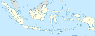
Tegal
Meal takeaway

Singkong Keju Tiar Jaya
Jalan Ks Tubun, Debong Tengah, Tegal Selatan, Debong Tengah

Tahu Sumedang Pisang Kipas Sukun
Rita Supermall, Jalan Kolonel Sugiono No.155, Kemandungan


Waffelicious
Rita Supermall Lantai LG, Jalan Kolonel Sugiono No. 155, Kemandungan


KRIBO Pisang KEJU
Jalan KH. W. Hasim, Mangkukusuman, Tegal Timur, Mangkukusuman

Mosque
Natural feature
Pet store


Bakery
📑 Tegal all categories
AccountingAdministrative area level 2Amusement parkArt galleryAtmBakeryBankBarBeauty salonBicycle storeBook storeBus stationCafeCampgroundCar dealerCar rentalCar repairCar washCemeteryChurchCity hallClothing storeConvenience storeCourthouseDentistDepartment storeDoctorElectricianElectronics storeFinanceFire stationFloristFoodFuneral homeFurniture storeGas stationGeneral contractorGrocery or supermarketGymHair careHardware storeHealthHindu TempleHome goods storeHospitalInsurance agencyJewelry storeLaundryLawyerLibraryLiquor storeLocal government officeLocalityLodgingMeal deliveryMeal takeawayMosqueMovie rentalMovie theaterMuseumNatural featureNight clubPainterParkParkingPet storePharmacyPhysiotherapistPlace of worshipPlumberPoint of interestPolicePost officePremiseReal estate agencyRestaurantRoofing contractorRouteSchoolShoe storeShopping mallSpaStadiumStorageStoreSupermarketTrain stationTransit stationTravel agencyUniversityVeterinary careadministrative area level 3administrative area level 4administrative area level 5