School nearby Sekolah Smp fahtaila
Indonesia
School nearby Sekolah Smp fahtaila
Sekolah Smp fahtaila
No.,, Jalan Doktor Semeru Raya No.43, RT.13/RW.7, Grogol Indonesia
contacts phone
:
+62
Latitude:
-6.159039
, Longitude:
106.796285
read more
nearest School
86 m
Sekolah Dasar Negeri Grogol 05 Pagi
Jalan Doktor Semeru Raya No.18, RT.9/RW.7, Grogol
School
read more
211 m
TK Tunas Bahagia
Jl. Semeru II 69 RT 008 RW 09 Kelurahan Grogol Grogol Petamburan Jakarta Barat DKI Jakarta, RT.13/RW.7, Grogol
School
read more
304 m
Sdn Kali Anyar Febie
Jalan Kalianyar Raya RT.3/RW.3, Kali Anyar
School
read more
360 m
SMK Tanjung , Grogol , Grogol Petamburan
Jalan Dokter Makaliwe I No.3, RT.1/RW.7, Grogol
School
read more
413 m
Mushola Shohibul Istikomah
Jalan Kali Anyar II RT.6/RW.5, Jembatan Besi
School
read more
555 m
Sekolah Dasar Muhammadiyah 10
Jalan Dokter Susilo I No.1, RT.7/RW.3, Grogol
School
read more
576 m
Vocational High School Candranaya
Jalan Kali Anyar X Gang 1 No.23, RT.2/RW.8, Jembatan Besi
School
read more
608 m
Yayasan Perguruan Sumbangsih Playgroup - Tk
Jalan Muwardi II No.13, RT.8/RW.2, Grogol
School
read more
762 m
Islamic University of Imam Shafi'i
Jalan Rawa Bahagia I No.7E, RT.1/RW.2, Grogol
School
read more
783 m
SEKOLAH WIDURI INDAH 1
Jl Duri Its Raya No.23, RT.8/RW.6, Duri Utara
School
read more
790 m
TK Damai
Jalan Duri Selatan V No.29, RT.2/RW.6, Duri Selatan
School
read more
888 m
Bimbel Infinity Class
V, Jalan Duri Selatan No.4, RT.12/RW.3, South Duri
School
read more
896 m
Sekolah Damai (SDM)
Jalan Duri Selatan V No.33, RT.14/RW.2, Duri Selatan
School
read more
903 m
LB LIA GROGOL
Gang II RT.6/RW.5, Grogol
School
read more
907 m
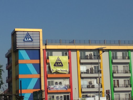
LIA GROGOL
Jalan Makaliwe Raya No. 35, Wijaya Kusuma, Grogol Petamburan, RT.2/RW.5, Grogol
School
read more
908 m
RA. QURROTA A'YUN (Dra. IDA WIDANINGSIH)
Jalan Jelambar P No.23, RT.3/RW.2, Jelambar Baru
School
read more
919 m
Aline gemini
Jalan Tanjung Duren Selatan RT.2/RW.2, Tanjung Duren Selatan
School
read more
949 m
SD Budi
Jl. Jembatan Besi II No. 44 RT 005 RW 03 Jembatan Besi Tambora Jakarta Barat DKI Jakarta, RT.10/RW.1, Jembatan Besi
School
read more
956 m
SDS Widuri Indah 2
RT.11/RW.2, Duri Selatan
School
read more
983 m
Management Of School
Jalan Kyai Tapa RT.6/RW.16, Tomang
School
read more
1.003 km
Elementary School North Duri 01
Jl. Duri Utara 1 No.3, RT.2/RW.7, Duri Utara, Kota Jakarta Barat
School
read more
1.01 km
SPS PAUD Mawar Merah
Jalan Jelambar Timur No.10, RT.14/RW.9, Jelambar Baru
School
read more
1.02 km
Sekolah Dasar Negeri Duri Utara 02
Jalan Duri Utara 1 RT.10/RW.8, Duri Utara
School
read more
1.047 km
Sekolah Menengah Pertama Cindera Mata Indah
Jalan Duri (Tss Raya) No.86, RT.1/RW.5, Duri Utara
School
read more
1.205 km
Universita Trisakti FSRD
Jalan Kyai Tapa No.1, RT.6/RW.16, Tomang
School
read more
📑
all categories
Accounting
Administrative area level 1
Administrative area level 2
Airport
Amusement park
Aquarium
Art gallery
Atm
Bakery
Bank
Bar
Beauty salon
Bicycle store
Book store
Bowling alley
Bus station
Cafe
Campground
Car dealer
Car rental
Car repair
Car wash
Casino
Cemetery
Church
City hall
Clothing store
Colloquial area
Convenience store
Courthouse
Dentist
Department store
Doctor
Electrician
Electronics store
Embassy
Finance
Fire station
Florist
Food
Funeral home
Furniture store
Gas station
General contractor
Grocery or supermarket
Gym
Hair care
Hardware store
Health
Hindu Temple
Home goods store
Hospital
Insurance agency
Intersection
Jewelry store
Laundry
Lawyer
Library
Liquor store
Local government office
Locality
Locksmith
Lodging
Meal delivery
Meal takeaway
Mosque
Movie rental
Movie theater
Moving company
Museum
Natural feature
Neighborhood
Night club
Painter
Park
Parking
Pet store
Pharmacy
Physiotherapist
Place of worship
Plumber
Point of interest
Police
Political
Post office
Premise
Real estate agency
Restaurant
Roofing contractor
Route
Rv park, camping
School
Shoe store
Shopping mall
Spa
Stadium
Storage
Store
Subpremise
Supermarket
Synagogue
Taxi stand
Train station
Transit station
Travel agency
University
Veterinary care
Zoo
administrative area level 3
administrative area level 4
administrative area level 5
sublocality level 1
↑