School nearby SDN Caringin 2
Indonesia
School nearby SDN Caringin 2
SDN Caringin 2
Caringin Indonesia
contacts phone
:
+62
Latitude:
-6.310054
, Longitude:
106.572216
read more
nearest School
344 m
PGRI SMPS 393 Palasari
Jalan Raya Palasari No.26, Palasari
School
read more
396 m
SDN Palasari III
Palasari
School
read more
401 m
MTS Ibnu Rosyad
Palasari
School
read more
534 m
Yayasan Ibnu Rosyad
Kemuning
School
read more
821 m
Madrasah Ibtidaiyah Nurul Falah
Caringin
School
read more
841 m
SDN Caringin III
Kemuning
School
read more
846 m
Mi Nurul Falah Palasari
mi nurul falah, Palasari
School
read more
947 m
Masjid Nurul Fallah Palasari
Palasari
School
read more
997 m
PAUD Al-Istiqomah
Perumahan Griya Permai Blok G2 No.14 Rt 005/006, 15820, Caringin
School
read more
1.136 km
TK. LITTLE STAR
Jalan Sadewa, Caringin
School
read more
1.257 km
Yayasan Suluk Insan Kamil
Kemuning
School
read more
1.342 km
SD Negeri 01 Lumpang
JL Raya Sudamanik, RT 003 RW 03, Legok, Caringin
School
read more
1.373 km
SDN Caringin 1
Jalan Raya Parung Panjang No.81, Caringin
School
read more
1.42 km
Pengembangan Bakat Computer Mandarin
Perum Dasana Indah RL2/16, Kel. Bonang, Kec. Kelapa Dua, Tangerang, Kemuning
School
read more
1.468 km
SDN KAMUNING
Jalan Bojong, Kemuning
School
read more
1.493 km
Pondok Pesantren Saung Songo
Caringin
School
read more
1.508 km
Aeroflyer Institute
Kemuning
School
read more
1.529 km
Alfuad Palasari
Palasari
School
read more
1.582 km
Majlis Ta'lim Thoriqotul Muhajirin
Palasari
School
read more
1.714 km
Elementary School Tadika Puri
komplek, Reni Jaya Barat 1F, Pondok Petir
School
read more
2.09 km
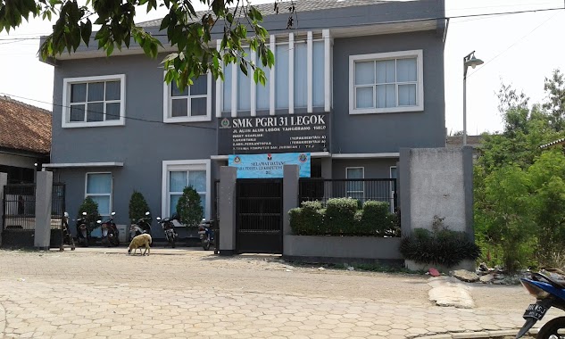
SMK PGRI 31 Legok
Jalan Alun Alun, Lapangan Legok, Tangerang, Babakan
School
read more
2.095 km
TK Bhayangkari
JL. Raya PLP Curug, RT 001/01
School
read more
2.106 km
TK Al-Ansor
Jalan Raya PLP Curug No.93, Kemuning
School
read more
2.242 km
SMPN 1 LEGOK
Jalan Lapangan Bola No.22, Babakan, Legok
School
read more
2.274 km
Sd Negeri Legok II
Jalan Raya Legok - Karawaci No.36, Babakan
School
read more
📑
all categories
Accounting
Administrative area level 1
Administrative area level 2
Airport
Amusement park
Aquarium
Art gallery
Atm
Bakery
Bank
Bar
Beauty salon
Bicycle store
Book store
Bowling alley
Bus station
Cafe
Campground
Car dealer
Car rental
Car repair
Car wash
Casino
Cemetery
Church
City hall
Clothing store
Colloquial area
Convenience store
Courthouse
Dentist
Department store
Doctor
Electrician
Electronics store
Embassy
Finance
Fire station
Florist
Food
Funeral home
Furniture store
Gas station
General contractor
Grocery or supermarket
Gym
Hair care
Hardware store
Health
Hindu Temple
Home goods store
Hospital
Insurance agency
Intersection
Jewelry store
Laundry
Lawyer
Library
Liquor store
Local government office
Locality
Locksmith
Lodging
Meal delivery
Meal takeaway
Mosque
Movie rental
Movie theater
Moving company
Museum
Natural feature
Neighborhood
Night club
Painter
Park
Parking
Pet store
Pharmacy
Physiotherapist
Place of worship
Plumber
Point of interest
Police
Political
Post office
Premise
Real estate agency
Restaurant
Roofing contractor
Route
Rv park, camping
School
Shoe store
Shopping mall
Spa
Stadium
Storage
Store
Subpremise
Supermarket
Synagogue
Taxi stand
Train station
Transit station
Travel agency
University
Veterinary care
Zoo
administrative area level 3
administrative area level 4
administrative area level 5
sublocality level 1
↑