School nearby SD Aulia
Coronavirus disease (COVID-19) Situation
confirmed cases
6829221
deaths
162063
Indonesia
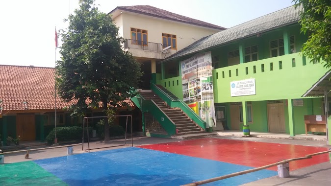
School nearby SD Aulia
SD Aulia
Jalan Raya Kranggan No.121, Jatisampurna, Bekasi, Kota Bks, Jawa Barat 17433, Indonesien
contacts phone
:
+62 21 84309763
Latitude:
-6.3582256
, Longitude:
106.9215705
larger map & directions
read more
nearest School
185 m
Madrasah Ibtidaiyah Raudlatul Mutaallimin Darul Abror
Jalan Camar No.38, RT.3/RW.7, Jatiraden
School
read more
275 m
Taman Kanak-Kanak Al-Fikri
Jalan Lindung No.11A, Jatiraden
School
read more
290 m
At Thoriq
Blok Sawo No., Jalan Kranggan Raya Blok Sawo No.5, Jatiraden
School
read more
384 m
SD ISLAM TERPADU IMAM BUKHORI
Jatiraden
School
read more
395 m
Tk Mutiara Islam
jalan nangka no, RT.003/RW.08, Jatiraden
School
read more
409 m
Insan Qur'ani
Jatiraden
School
read more
454 m
SDN Jatisampurna IV
Jalan Sawo 2 RT. 003/04, Jatiraden
School
read more
474 m
Sekolah Dasar Negeri Jatisampurna III
Jalan Lindung RT.5/RW.• 9, Jatiraden
School
read more
515 m
SIT Al Ishmah
Jalan Raya Pasar Kranggan Blok Ag No.11, Jatiraden
School
read more
586 m
Musola Araudhoh
Jalan Elang IX No.22-27, Jatiraden
School
read more
589 m
Sekolah Dasar Negeri Jatisampurna X
Jalan Raya Pasar Kranggan No.25, Jatisampurna
School
read more
600 m
TK Tahfidz Imam Muslim
Jl. Elang RT. 02/03 Kelurahan Jati Raden, Jatiraden
School
read more
621 m
SDIT Hidayatutaufik
Jatisampurna
School
read more
678 m
SMK Melati Sari
Jalan Pertamina. B, Jatiraden
School
read more
732 m
Generasi Mandiri English Course
Blok P. Dongos, Jalan Raya Kranggan Blok P. Dongos No.23, Jatiraden
School
read more
755 m
TK Ceria
Jatisampurna
School
read more
815 m
TPQ Ar-Rouyani
No., Jalan Bhakti Warga No.4, Jatisampurna
School
read more
840 m
Pendapa Bhinneka Dharma
Jalan Hidayah No.67b, Jatiraden
School
read more
856 m
Yspi Darul Kirom
Jatiraden
School
read more
863 m
SMP Islam Darul Kirom
Jalan Emerald IX No.22, RT.1/RW.3, Jatiraden
School
read more
910 m
Pondok Pesantren Miftahul Huda
Jalan Hidayah No.41, Jatiraden
School
read more
979 m
Pesantren Miftahulhuda
JL Raya Kranggan, Gang Huda RT 001 RW 08, Jatiraden
School
read more
980 m
Sma Negri 7
Jalan Bhakti Warga No.21, Jatisampurna
School
read more
988 m
Smk 4 Jatirangga
Jalan Bhakti Warga No.21, Jatisampurna
School
read more
1.096 km
PAUD Camar
Jl. Camar No.15 RT 04 RW 07Jatiraden Jatisampurna Kota Bks,, Jatiraden
School
read more
📑
all categories
Accounting
Administrative area level 1
Administrative area level 2
Airport
Amusement park
Aquarium
Art gallery
Atm
Bakery
Bank
Bar
Beauty salon
Bicycle store
Book store
Bowling alley
Bus station
Cafe
Campground
Car dealer
Car rental
Car repair
Car wash
Casino
Cemetery
Church
City hall
Clothing store
Colloquial area
Convenience store
Courthouse
Dentist
Department store
Doctor
Electrician
Electronics store
Embassy
Finance
Fire station
Florist
Food
Funeral home
Furniture store
Gas station
General contractor
Grocery or supermarket
Gym
Hair care
Hardware store
Health
Hindu Temple
Home goods store
Hospital
Insurance agency
Intersection
Jewelry store
Laundry
Lawyer
Library
Liquor store
Local government office
Locality
Locksmith
Lodging
Meal delivery
Meal takeaway
Mosque
Movie rental
Movie theater
Moving company
Museum
Natural feature
Neighborhood
Night club
Painter
Park
Parking
Pet store
Pharmacy
Physiotherapist
Place of worship
Plumber
Point of interest
Police
Political
Post office
Premise
Real estate agency
Restaurant
Roofing contractor
Route
Rv park, camping
School
Shoe store
Shopping mall
Spa
Stadium
Storage
Store
Subpremise
Supermarket
Synagogue
Taxi stand
Train station
Transit station
Travel agency
University
Veterinary care
Zoo
administrative area level 3
administrative area level 4
administrative area level 5
sublocality level 1
↑