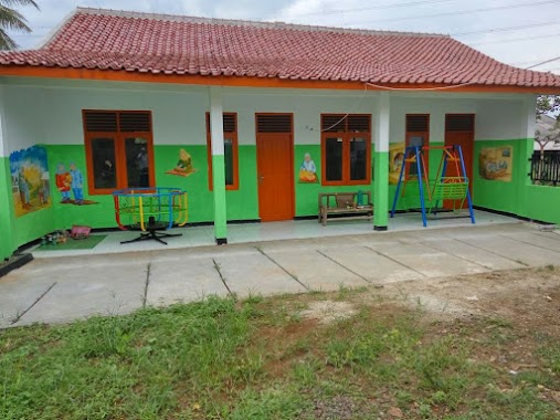
School nearby Paud Al Badar
Coronavirus disease (COVID-19) Situation
confirmed cases
6829221
deaths
162063
Indonesia
School nearby Paud Al Badar
Paud Al Badar
Jalan Kampung Benda Barat No.93, Cipayung Indonesien
contacts phone
:
+62
Latitude:
-6.4171567
, Longitude:
106.7881541
read more
nearest School
276 m
SMP NEGRI 9 DEPOK
Gang Mardan 2, Cipayung
School
read more
413 m
sdn nanggerang2
Jalan Kampung Benda Barat No.51, Cipayung
School
read more
635 m
Elementary School Rawadenok
Jalan Raya Keadilan No.26, RT.1/RW.8, Rangkapan Jaya Baru, Pancoran Mas, Rangkapan Jaya Baru
School
read more
803 m
Sekolah Menengah Pertama Islam Al-Istiqomah
Jalan Raya Jembatan Serong No.14, Cipayung
School
read more
824 m
SMPN 9 Depok
Jalan Raya Cipayung Jaya No.27, Cipayung
School
read more
836 m
SD Cipayung 3
Jalan Kel Cipayung No.33, Cipayung
School
read more
836 m
Sekolah Dasar Negeri Cipayung 1
Jalan Raya Jembatan Serong No.16, Cipayung
School
read more
841 m
Nurul Huda Cipayung
Jalan Raya Jembatan Serong No.14, Cipayung
School
read more
862 m
Al Hidayah Boarding School
Jalan Raya Keadilan, Rangkapan Jaya Baru
School
read more
870 m
Smpn9gograbC9D
Jalan Gang H.Bahrudin
School
read more
870 m
Smp Negeri 9 Depok
Jalan Gang H.Bahrudin
School
read more
873 m
Pondok Pesantren Al-Hidayah Depok
RT. 02 RW. 01, Jalan Raya Keadilan No.10, Rangkapan Jaya Baru
School
read more
873 m
MIS AL HIDAYAH RAWADENOK
Jalan Raya Keadilan No.10, Rangkapan Jaya Baru, Pancoran MAS, Rangkapan Jaya Baru
School
read more
881 m
Madrasah Tsanawiyah Al-Hidayah Depok
Jalan Raya Keadilan No.10, RT.2/RW.1, Rangkapan Jaya Baru
School
read more
885 m
SDN CIPAYUNG 03
jln bulak indah kp bulak barat Rt03/07 no 79, Jalan Kelurahan Cipayung, Cipayung
School
read more
897 m
Yayasan Al Hidayah
Jalan Raya Keadilan No.84, RT.4/RW.1, Rangkapan Jaya Baru
School
read more
914 m
Aisyiyah 21 Depok
Jalan Raya Jembatan Serong, Cipayung
School
read more
934 m
MI Muhammadiyah 2
Jalan Raya Cipayung No.55, RT.1/RW.4, Cipayung
School
read more
951 m
Jakampus_UP Region Pasir Putih
Jalan Kampung . Pasir Putih No.38, Pasir Putih
School
read more
960 m
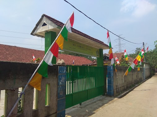
MI Khoirul Huda
Jalan Mawar, Pasir Putih
School
read more
1.02 km
TK Al-Amin
Blok Haji Ridhi, Jalan Raya Pasir Putih Blok Haji Ridhi No.19, Pasir Putih
School
read more
1.068 km
Pratama Resident3
Rangkapan Jaya Baru
School
read more
1.069 km
Ponpes Hidayatul Mubtadi-ien Pasir Putih
Gang Masjid, Pasir Putih
School
read more
1.201 km
YPI Darussyarif
Jalan Anggrek, Cipayung
School
read more
1.312 km
FAWWAZ SCHOOL
Jalan Rawa Geni Raya No.11, RT.1/RW.1, Pasir Putih
School
read more
📑
all categories
Accounting
Administrative area level 1
Administrative area level 2
Airport
Amusement park
Aquarium
Art gallery
Atm
Bakery
Bank
Bar
Beauty salon
Bicycle store
Book store
Bowling alley
Bus station
Cafe
Campground
Car dealer
Car rental
Car repair
Car wash
Casino
Cemetery
Church
City hall
Clothing store
Colloquial area
Convenience store
Courthouse
Dentist
Department store
Doctor
Electrician
Electronics store
Embassy
Finance
Fire station
Florist
Food
Funeral home
Furniture store
Gas station
General contractor
Grocery or supermarket
Gym
Hair care
Hardware store
Health
Hindu Temple
Home goods store
Hospital
Insurance agency
Intersection
Jewelry store
Laundry
Lawyer
Library
Liquor store
Local government office
Locality
Locksmith
Lodging
Meal delivery
Meal takeaway
Mosque
Movie rental
Movie theater
Moving company
Museum
Natural feature
Neighborhood
Night club
Painter
Park
Parking
Pet store
Pharmacy
Physiotherapist
Place of worship
Plumber
Point of interest
Police
Political
Post office
Premise
Real estate agency
Restaurant
Roofing contractor
Route
Rv park, camping
School
Shoe store
Shopping mall
Spa
Stadium
Storage
Store
Subpremise
Supermarket
Synagogue
Taxi stand
Train station
Transit station
Travel agency
University
Veterinary care
Zoo
administrative area level 3
administrative area level 4
administrative area level 5
sublocality level 1
↑