School nearby MTs Cakrawala Cendekia
Indonesia
School nearby MTs Cakrawala Cendekia
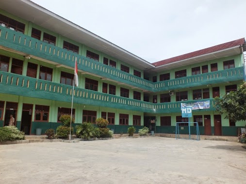
MTs Cakrawala Cendekia
5, Jalan Desa Ciseeng, 16120, Bogor, Jawa Barat, ID Indonesia
contacts phone
:
+62
Latitude:
-6.4429082
, Longitude:
106.6915711
larger map & directions
read more
nearest School
58 m
MI Matlaul Anwar
Jalan Desa Ciseeng No.5, Ciseeng
School
read more
90 m
SMK Harapan
Jl. H. Usa No. 10, Desa Malang Nengah, Ciseeng
School
read more
135 m
MIS MATHLA'UL ANWAR CISEENG
Jl. Nengah RT. 01 / RW. 02, Ciseeng
School
read more
155 m
Villa Penghafal Al-Quran
JL H. Usa Gg Balai Desa, RT 4 RW 2 No. 1A, Malung Nengah, Ciseeng, Ciseeng
School
read more
162 m
SMP PLUS PEWARIS PERADABAN
Jalan Malang Nengah, Ciseeng
School
read more
163 m
MIS MATHLAUL ANWAR CISEENG
Jalan Desa Ciseeng No.10, Ciseeng
School
read more
211 m
SDN CISEENG 1
Jalan Raya Haji Usa No.271, Parigi Mekar
School
read more
212 m
SDN Ciseeng 01
Jalan Raya Haji Usa
School
read more
260 m
MIS. TAUFIQUL ATHFAL
Kp. Setu, Parigi Mekar
School
read more
429 m
PONPES VILLA PENGHAFAL AL QUR'AN AL HAFIZH
Cihoe
School
read more
443 m
Ponpes Villa Alhafizh
Cihoe
School
read more
492 m
SMP Islam Al - Mukhlisin
Jalan Raya Haji Usa No.04, RT.003, Cibentang
School
read more
492 m
MTs. Al-Ittihadiyah
Parigi Mekar
School
read more
535 m
MA Al-Mukhlishin
Jalan Raya Haji Usa, Ciseeng
School
read more
749 m
Madrasah Diniyah As Syafiiyah
Bojong Indah
School
read more
779 m
SDN Ciseeng 02
Parigi Mekar
School
read more
915 m
MAS Al Irsyadiyah
JL. Inpres Desa Cibeuteung Udik, Ciseeng, Cibentang
School
read more
916 m
SD Muhammadiyah 58 Parung
Jalan Raya Ciseeng, Bojong Indah
School
read more
947 m
MAS Al Manar
Jalan AMD Cibentang No.184, Cibentang
School
read more
1.017 km
Pondok Ufa
Bojong Indah
School
read more
1.047 km
SMA Muhammadiyah Parung
JL. Ciseeng Gunung kapur Desa Bojong Indah Parung, Jawa Barat16330, Kampung Parung Jambu, Bojong Indah
School
read more
1.07 km
gedung 2 smk muhammadiyah parung
Bojong Indah
School
read more
1.089 km
TK Aisyiyah 77
Jalan H Mawi, Bojong Indah, Parung, Bojong Indah
School
read more
1.101 km
PAUD Aisyiyah Al-Amin
Jalan H. Mawi No. 292, Bojong Indah, Parung, Bojong Indah
School
read more
1.11 km
Yayasan Arrahman
Gang Irbi, Bojong Indah
School
read more
📑
all categories
Accounting
Administrative area level 1
Administrative area level 2
Airport
Amusement park
Aquarium
Art gallery
Atm
Bakery
Bank
Bar
Beauty salon
Bicycle store
Book store
Bowling alley
Bus station
Cafe
Campground
Car dealer
Car rental
Car repair
Car wash
Casino
Cemetery
Church
City hall
Clothing store
Colloquial area
Convenience store
Courthouse
Dentist
Department store
Doctor
Electrician
Electronics store
Embassy
Finance
Fire station
Florist
Food
Funeral home
Furniture store
Gas station
General contractor
Grocery or supermarket
Gym
Hair care
Hardware store
Health
Hindu Temple
Home goods store
Hospital
Insurance agency
Intersection
Jewelry store
Laundry
Lawyer
Library
Liquor store
Local government office
Locality
Locksmith
Lodging
Meal delivery
Meal takeaway
Mosque
Movie rental
Movie theater
Moving company
Museum
Natural feature
Neighborhood
Night club
Painter
Park
Parking
Pet store
Pharmacy
Physiotherapist
Place of worship
Plumber
Point of interest
Police
Political
Post office
Premise
Real estate agency
Restaurant
Roofing contractor
Route
Rv park, camping
School
Shoe store
Shopping mall
Spa
Stadium
Storage
Store
Subpremise
Supermarket
Synagogue
Taxi stand
Train station
Transit station
Travel agency
University
Veterinary care
Zoo
administrative area level 3
administrative area level 4
administrative area level 5
sublocality level 1
↑