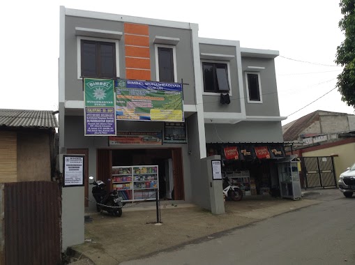
School nearby Madrasah Diniyah
Coronavirus disease (COVID-19) Situation
confirmed cases
6829221
deaths
162063
Indonesia
School nearby Madrasah Diniyah
Madrasah Diniyah
Jalan Raya Ceger, 13820, Kota Jakarta Timur, Daerah Khusus Ibukota Jakarta, ID Indonesia
contacts phone
:
+62
Latitude:
-6.3068761
, Longitude:
106.8884475
larger map & directions
read more
nearest School
64 m
STAR JAKARTA
No. Raya Ruko No.3B, Jalan Raya Ceger RT.2/RW.2, Ceger
School
read more
205 m
Markaz Tahfizh Al-Qur'an Soleh Dan Hawa
Jalan Raya Ceger No.2, RT.5/RW.1, Ceger
School
read more
393 m
SMP 32 Makassar
Jalan SMP CCXXII Blok Kenanga No.32, RT.5/RW.2, Ceger
School
read more
398 m
Kelompok Bermain Saraswati
Jalan Remaja No.20, RT.2/RW.1, Ceger
School
read more
401 m
SMP 222 SSN Ceger
Jalan Rawa Segaran No.81, RT.3/RW.2, Ceger
School
read more
454 m
Taman Kanak-Kanak Mekar Wangi
Jalan Angkasa No.14, RT.9/RW.2, Ceger
School
read more
490 m
SD St Ana
Jl. Angkasa 14 RT 009 %2F RW 02 Ceger Cipayung Jakarta Timur DKI Jakarta, Ceger
School
read more
519 m
Jakarta Intercultural Korea School
Jalan Raya Ceger RT.9/RW.2, Ceger
School
read more
580 m
TK Kartika XI-40
Jalan Raya Ceger RW.3, Ceger
School
read more
582 m
Paud Al - Ishlahiyah
Yayasan Ibnu Yahya Al - Ishlahiyah, Jalan Raya Ceger No.21 A, RT.3/RW.1, Ceger
School
read more
667 m
TK Islam Attaufiq
Yayasan At Taufiq, Jalan Gempol Raya No.11, RT.7/RW.2, Ceger
School
read more
737 m
TK At Taufiq
Jl. Raya Gempol 11 RT 007 %2F RW 02 Ceger Cipayung Jakarta Timur DKI Jakarta, RT.6/RW.2, Ceger
School
read more
741 m
Asas Islamic School
Jalan SMPN 160 No.60, RT.3/RW.1, Ceger
School
read more
754 m
SMP SMK CAGAR BUDAYA
JL GEMPOL No.47, RT.6/RW.2, Bambu Apus
School
read more
768 m
Taman Kanak-Kanak (TK) At Taufiq
Jalan Gempol Raya No.12, RT.6/RW.2, Bambu Apus
School
read more
899 m
aha smart Ceger
Gang Anggur No.44, Ceger
School
read more
913 m
SDN Bambu Apus 03 Pagi
Jalan Al-Ikhlas RT.1/RW.2, Bambu Apus
School
read more
939 m
Sekolah Paket Jakarta Timur - Al Amiria
Jalan Bungur III RT. 10/006 Kelurahan Rambutan Kecamatan Ciracas, RT.15/RW.6, Rambutan
School
read more
959 m
TPA Qurrota A'yun UMI KEMBAR
Jalan Bungur IV No.97, Rambutan
School
read more
959 m
TPA Qurrota A'yun UMI KEMBAR
Jalan Bungur IV No.97, RT.15/RW.6, Rambutan
School
read more
1.056 km
Yayasan Nurul Hidayah Al-Mursyidiyyah
Jalan Tanah Merdeka 6 No.2, RT.5/RW.6, Rambutan
School
read more
1.19 km
Raudhatul Athfal Al Falah
Al - Falah, Jalan Bambu Apus Raya No.55, RT.1/RW.4, Ceger
School
read more
1.197 km
Taman Pendidikan Al - Qur'an Al Falah
Al - Falah, Jalan Bambu Apus Raya No.55, RT.1/RW.4, Ceger
School
read more
1.211 km
RA AL FALAH
Jalan Bambu Apus Raya No.55, Ceger
School
read more
1.282 km
Bimbel Muhammadiyah Dukuh
Jalan Dukuh V RT.4/RW.4, Dukuh
School
read more
📑
all categories
Accounting
Administrative area level 1
Administrative area level 2
Airport
Amusement park
Aquarium
Art gallery
Atm
Bakery
Bank
Bar
Beauty salon
Bicycle store
Book store
Bowling alley
Bus station
Cafe
Campground
Car dealer
Car rental
Car repair
Car wash
Casino
Cemetery
Church
City hall
Clothing store
Colloquial area
Convenience store
Courthouse
Dentist
Department store
Doctor
Electrician
Electronics store
Embassy
Finance
Fire station
Florist
Food
Funeral home
Furniture store
Gas station
General contractor
Grocery or supermarket
Gym
Hair care
Hardware store
Health
Hindu Temple
Home goods store
Hospital
Insurance agency
Intersection
Jewelry store
Laundry
Lawyer
Library
Liquor store
Local government office
Locality
Locksmith
Lodging
Meal delivery
Meal takeaway
Mosque
Movie rental
Movie theater
Moving company
Museum
Natural feature
Neighborhood
Night club
Painter
Park
Parking
Pet store
Pharmacy
Physiotherapist
Place of worship
Plumber
Point of interest
Police
Political
Post office
Premise
Real estate agency
Restaurant
Roofing contractor
Route
Rv park, camping
School
Shoe store
Shopping mall
Spa
Stadium
Storage
Store
Subpremise
Supermarket
Synagogue
Taxi stand
Train station
Transit station
Travel agency
University
Veterinary care
Zoo
administrative area level 3
administrative area level 4
administrative area level 5
sublocality level 1
↑