Police nearby Polsubsektor Gandul
Coronavirus disease (COVID-19) Situation
confirmed cases
6829221
deaths
162063
Indonesia
Police nearby Polsubsektor Gandul
Polsubsektor Gandul
Jalan Raya Gandul No.1, RT.04, Gandul Indonesia
contacts phone
:
+62
Latitude:
-6.3401304
, Longitude:
106.7934482
read more
nearest Police
1.371 km
Pos Polisi Cinere
Cinere
Police
read more
1.471 km
Polsek Limo
Jalan Cinere Raya No.20, Cinere
Police
read more
1.524 km
Polsek Limo
Jalan Cinere Raya No.136, Cinere
Police
read more
2.016 km
Polsek Jagakarsa
Jalan Timbul No.39, RT.6/RW.5, Cipedak, Jagakarsa, RT.6/RW.5, Cipedak
Police
read more
2.214 km
Polsubsektor Pangkalan Jati
Jalan Cinere Raya No.1, Pangkalan Jati
Police
read more
2.358 km
Pospol Ciganjur
Jl. Raya Ciganjur, RT.2/RW.2, Ciganjur
Police
read more
2.656 km
Villa Cinere Mas Police
Tim., Pisangan
Police
read more
2.68 km
Pos Polisi Villa Cinere Mas
Jalan Taman Mercurius, Pisangan
Police
read more
2.728 km
Pos Jaga
Jalan Komanmuin No.3, Limo
Police
read more
2.942 km
Pos Keamanan
Jalan Pangkalan Jati RT.14/RW.1, Pondok Labu
Police
read more
3.083 km
Polsek Pondok Labu
Jalan Margasatwa Blok Hj. Saleh No.10, RT.15/RW.1, Pondok Labu
Police
read more
3.31 km
Sispamdu Polsek Metro Metro Jagakarsa
Jalan Jagakarsa Raya No.34, RT.9/RW.5, Jagakarsa
Police
read more
3.5 km
Direktorat Kepolisian Udara
Jalan Talas 2 No. 13, Pondok Cabe Ilir, Pamulang, Pondok Cabe Ilir
Police
read more
3.61 km
Mako Polisi Udara
Jalan Talas 2 No.17, Pondok Cabe Ilir
Police
read more
3.612 km
Pospol Pondok Cabe
Jl. Pelita Air Service, Pondok Cabe Ilir
Police
read more
3.906 km
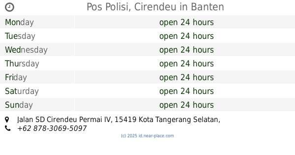
Pos Polisi, Cirendeu
Jalan SD Cirendeu Permai IV, Cireundeu
Police
read more
3.923 km
POLSEK METRO CIPUTAT, SUBSEKTOR CIRENDEU
Jalan Cirendeu Raya No.23, Cireundeu
Police
read more
4.185 km
Pos Lantas Fatmawati
Jl. Raya Fatmawati
Police
read more
4.458 km
Pospol Ragunan
Jl. Kebon Binatang, RT.10/RW.7, Ragunan
Police
read more
4.484 km
Pospol Lenteng Agung
Gang Mesjid
Police
read more
4.582 km
Polsek Beji
Jalan Haji Asmawi No.23, Beji
Police
read more
4.613 km
Pos Polisi
RT.1/RW.1, Srengseng Sawah
Police
read more
4.738 km
Polsub Sektor Lenteng Agung
Jalan Raya Lenteng Agung Blok Haji Djoko No.33, RT.13/RW.7, Lenteng Agung
Police
read more
5.422 km
Pos Polisi Ragunan
Jalan Harsono Rm Jakarta Selatan RT.9/RW.4, Ragunan
Police
read more
5.484 km
MABES PELEK
Jalan Ir Haji Juanda Blok Swadaya No.154, Pisangan
Police
read more
📑
all categories
Accounting
Administrative area level 1
Administrative area level 2
Airport
Amusement park
Aquarium
Art gallery
Atm
Bakery
Bank
Bar
Beauty salon
Bicycle store
Book store
Bowling alley
Bus station
Cafe
Campground
Car dealer
Car rental
Car repair
Car wash
Casino
Cemetery
Church
City hall
Clothing store
Colloquial area
Convenience store
Courthouse
Dentist
Department store
Doctor
Electrician
Electronics store
Embassy
Finance
Fire station
Florist
Food
Funeral home
Furniture store
Gas station
General contractor
Grocery or supermarket
Gym
Hair care
Hardware store
Health
Hindu Temple
Home goods store
Hospital
Insurance agency
Intersection
Jewelry store
Laundry
Lawyer
Library
Liquor store
Local government office
Locality
Locksmith
Lodging
Meal delivery
Meal takeaway
Mosque
Movie rental
Movie theater
Moving company
Museum
Natural feature
Neighborhood
Night club
Painter
Park
Parking
Pet store
Pharmacy
Physiotherapist
Place of worship
Plumber
Point of interest
Police
Political
Post office
Premise
Real estate agency
Restaurant
Roofing contractor
Route
Rv park, camping
School
Shoe store
Shopping mall
Spa
Stadium
Storage
Store
Subpremise
Supermarket
Synagogue
Taxi stand
Train station
Transit station
Travel agency
University
Veterinary care
Zoo
administrative area level 3
administrative area level 4
administrative area level 5
sublocality level 1
↑