Night club nearby Shetre BIT KEMENTRIAN AGAMA - BROJOL
Indonesia
Night club nearby Shetre BIT KEMENTRIAN AGAMA - BROJOL
Shetre BIT KEMENTRIAN AGAMA - BROJOL
No.18I, Jalan Raya Pondok Gede, 13560, Kota Jakarta Timur, Daerah Khusus Ibukota Jakarta, ID Indonesia
contacts phone
:
+62
Latitude:
-6.29087
, Longitude:
106.886439
larger map & directions
read more
nearest Night club
132 m
DD FORTUNA
Jalan Raya Pondok Gede No.40, RT.6/RW.2, Pinang Ranti
Night club
read more
536 m
Workshop
Jalan Pinang Ranti No.2, RT.8/RW.1, Pinang Ranti
Night club
read more
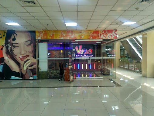
584 m
Venus Karaoke
Mall Tamini Square Lantai 2, Jl. Taman Mini Raya, Pinang Ranti, Makasar, RT.3/RW.2, Pinang Ranti
Night club
read more
761 m
SOTO TANGKAR Q SUBUR
Jalan Raya Pondok Gede No.23, RT.2/RW.4, Halim Perdana Kusumah
Night club
read more
776 m
Parkiran Arippp
Jalan Makmur No.3, RT.3/RW.7, Lubang Buaya
Night club
read more
968 m
Markas TELOLET
Jalan Pusdiklat Depnaker RT.13/RW.6, Makasar
Night club
read more
1.142 km
Two Door Boys
Jalan Taman Mini II No.17, RT.14/RW.3, Lubang Buaya
Night club
read more
1.218 km
ARC R15JAKARTA
RW.3, Pinang Ranti
Night club
read more
1.41 km
Sewa Band Akustik Di Jakarta
Jalan Pusdiklat Depnaker No.3, RT.11/RW.6, Makasar
Night club
read more
1.442 km
Grand Charly Karaoke TMII
Green Terrace TMII Blok C Lantai 2 No. 1-16, Jl. Mabes Hankam, Ceger, Cipayung, Ceger
Night club
read more
1.683 km
Grand Charly
Jalan Mabes Hankam RT.10/RW.1, Lubang Buaya
Night club
read more
1.752 km
Pos Hansip
Jalan Datuk Tonggara RT.11/RW.10, Kramat Jati
Night club
read more
1.768 km
Aswag 1906
Jalan Swadaya Murni II RT.3/RW.11, Lubang Buaya
Night club
read more
1.882 km
V.R.C Lubang Buaya
B, Jalan Al.Baidho I No.74, RT.2/RW.6, Lubang Buaya
Night club
read more
1.891 km
Tempat Karaoke Celilitan
Kampung Tengah, Kramatjati, RT.3/RW.1, Kampung Tengah
Night club
read more
1.901 km
Rumah Naisa
Jalan Kerja Bakti No.43, RT.3/RW.4, Makasar
Night club
read more
1.989 km
Bali Rambutan
RT.11/RW.6, Rambutan
Night club
read more
2.015 km
SARIIE
Jalan SMP CCXXII No.95, RT.2/RW.2, Ceger
Night club
read more
2.188 km
Terminal International Rambutan
Gang Molen No.78, RT.11/RW.4, Rambutan
Night club
read more
2.248 km
Titik Temu Merbabu
Jalan Raya Mabes Hankam No.9A, RT.5/RW.2, Bambu Apus
Night club
read more
2.257 km
Demiit Rebo
Jalan Trikora Blok Haji Taiman Barat No.4, RT.6/RW.2, Gedong
Night club
read more
2.772 km
WARNET GAMERS
Jalan Haji Taiman No.20G, RT.4/RW.10, Gedong
Night club
read more
2.782 km
Base Of Gojeg
Jalan TB Simatupang No.64, RT.7/RW.3, Susukan
Night club
read more
2.836 km
Club Sinc
Ruko Plaza Pondok Gede, Jalan Raya Pondok Gede Blok C No.14-15, RT.1/RW.12, Jatiwaringin
Night club
read more
2.928 km
Indihome Joget Joget
No. Jl. Cililitan Besar No, RT.7/RW.11, Kebon Pala
Night club
read more
📑
all categories
Accounting
Administrative area level 1
Administrative area level 2
Airport
Amusement park
Aquarium
Art gallery
Atm
Bakery
Bank
Bar
Beauty salon
Bicycle store
Book store
Bowling alley
Bus station
Cafe
Campground
Car dealer
Car rental
Car repair
Car wash
Casino
Cemetery
Church
City hall
Clothing store
Colloquial area
Convenience store
Courthouse
Dentist
Department store
Doctor
Electrician
Electronics store
Embassy
Finance
Fire station
Florist
Food
Funeral home
Furniture store
Gas station
General contractor
Grocery or supermarket
Gym
Hair care
Hardware store
Health
Hindu Temple
Home goods store
Hospital
Insurance agency
Intersection
Jewelry store
Laundry
Lawyer
Library
Liquor store
Local government office
Locality
Locksmith
Lodging
Meal delivery
Meal takeaway
Mosque
Movie rental
Movie theater
Moving company
Museum
Natural feature
Neighborhood
Night club
Painter
Park
Parking
Pet store
Pharmacy
Physiotherapist
Place of worship
Plumber
Point of interest
Police
Political
Post office
Premise
Real estate agency
Restaurant
Roofing contractor
Route
Rv park, camping
School
Shoe store
Shopping mall
Spa
Stadium
Storage
Store
Subpremise
Supermarket
Synagogue
Taxi stand
Train station
Transit station
Travel agency
University
Veterinary care
Zoo
administrative area level 3
administrative area level 4
administrative area level 5
sublocality level 1
↑