Night club nearby GOL'S Speed Eka Putra
Indonesia
Night club nearby GOL'S Speed Eka Putra
GOL'S Speed Eka Putra
5, Jalan Perum. Depok Maharaja, 16435, Kota Depok, Jawa Barat, ID Indonesia
contacts phone
:
+62
Latitude:
-6.399994
, Longitude:
106.79337
larger map & directions
read more
nearest Night club
563 m
Princess Karaoke
Depok Town Centre, Jalan Raya Sawangan, Rangkapan Jaya
Night club
read more
599 m
Mirza Amrullah Muthi
Mall Depok Town Center (DTC) L1/A/08, JL. Raya Sawangan, No. 1, Mampang
Night club
read more
1.137 km
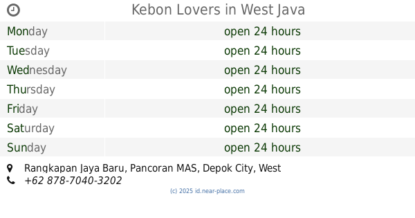
Kebon Lovers
Rangkapan Jaya Baru
Night club
read more
1.303 km
prapatan uki pitara Depok
Jalan Pitara No.28, Pancoran MAS
Night club
read more
1.364 km
Justice Street,Kerjaan Kaki
Rangkapan Jaya Baru
Night club
read more
1.425 km
Hendra Locket
Jalan Pitara No.175, Pancoran MAS
Night club
read more
1.591 km
pp kalila
Night club
read more
1.591 km
pp kalila
Pancoran MAS
Night club
read more
1.644 km
Bakso geluduk
Jalan Benda 2 No.110, Rangkapan Jaya Baru
Night club
read more
1.873 km
warsam coffee joy
Jalan Pitara, Pancoran MAS
Night club
read more
1.918 km
AHAY
Jalan Raya Cagar Alam No.5, Pancoran MAS
Night club
read more
1.951 km
KituL Night Club
Mampang
Night club
read more
2.056 km
gondel goorot
Cipayung
Night club
read more
2.168 km
Pherdoy's Safehouse
Jalan Haji Tamad Firdaus No.143, Cipayung
Night club
read more
2.527 km
BUKAAN MAIN
Jalan Program Raya IV B Blok Dalam No.21, Pancoran MAS
Night club
read more
2.703 km
Sahabat Gubug
Jalan Mawar, Pasir Putih
Night club
read more
2.85 km
BMLS Depok
Jalan Kartini No.80, Depok
Night club
read more
2.85 km
Kopdaran COSMO Depok
Jalan Margonda Raya No.20, Depok
Night club
read more
2.974 km
Twix Customize garage
Depok
Night club
read more
3.082 km
BC S.U.D & D.E.T.O.S
Unnamed Road
Night club
read more
3.171 km
HOTEL RODEO 77
Jalan Rawa Geni Raya No.87, Ratu Jaya
Night club
read more
3.308 km
Heaven Dreams
Ratu Jaya
Night club
read more
3.341 km
Warkop Pak Harun
Jalan Kampung Ratu Jaya No.47A, Ratu Jaya
Night club
read more
3.403 km
bale Males
Jalan Masjid RT.9/RW.5, no 123
Night club
read more
3.485 km
ChelNET
Jalan Raya Meruyung No.12, Meruyung
Night club
read more
📑
all categories
Accounting
Administrative area level 1
Administrative area level 2
Airport
Amusement park
Aquarium
Art gallery
Atm
Bakery
Bank
Bar
Beauty salon
Bicycle store
Book store
Bowling alley
Bus station
Cafe
Campground
Car dealer
Car rental
Car repair
Car wash
Casino
Cemetery
Church
City hall
Clothing store
Colloquial area
Convenience store
Courthouse
Dentist
Department store
Doctor
Electrician
Electronics store
Embassy
Finance
Fire station
Florist
Food
Funeral home
Furniture store
Gas station
General contractor
Grocery or supermarket
Gym
Hair care
Hardware store
Health
Hindu Temple
Home goods store
Hospital
Insurance agency
Intersection
Jewelry store
Laundry
Lawyer
Library
Liquor store
Local government office
Locality
Locksmith
Lodging
Meal delivery
Meal takeaway
Mosque
Movie rental
Movie theater
Moving company
Museum
Natural feature
Neighborhood
Night club
Painter
Park
Parking
Pet store
Pharmacy
Physiotherapist
Place of worship
Plumber
Point of interest
Police
Political
Post office
Premise
Real estate agency
Restaurant
Roofing contractor
Route
Rv park, camping
School
Shoe store
Shopping mall
Spa
Stadium
Storage
Store
Subpremise
Supermarket
Synagogue
Taxi stand
Train station
Transit station
Travel agency
University
Veterinary care
Zoo
administrative area level 3
administrative area level 4
administrative area level 5
sublocality level 1
↑