Mosque nearby Musollah Al Barkah
Indonesia
Mosque nearby Musollah Al Barkah
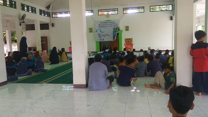
Musollah Al Barkah
Jalan Raya Parakan Jati, Susukan Indonesia
contacts phone
:
+62
Latitude:
-6.4731561
, Longitude:
106.7950826
read more
nearest Mosque
9 m
Mushola Al Barkah
Susukan
Mosque
read more
185 m
Mushola Attaufik
Susukan
Mosque
read more
367 m
Musollal Nurul Hikmah Parakanjati
Jalan Raya Parakan Jati, Susukan
Mosque
read more
372 m
Masjid Jami Raudhatul Muflihin
Susukan
Mosque
read more
423 m
Masjid Hayatul Ubudiah
Jalan Raya Parakan Jati, Susukan
Mosque
read more
462 m
Musholah At-Taqwa
Pabuaran
Mosque
read more
517 m
Masjid Al-Ikhlas
Perum Villa Asia
Mosque
read more
524 m
Masjid Al Ikhlash
Jalan Perum Villa Asia Blok C14 No.1, RT.4/RW.9, Susukan
Mosque
read more
631 m
Musholla Al Hidayah
Jalan Perum Villa Asia No.C8, Bojong Gede, Susukan
Mosque
read more
679 m
Masjid Al Muhajirin
Jalan Air Langga I, Pabuaran
Mosque
read more
679 m
Masjid Jami Al Muhajirin
Jalan Air Langga I, Pabuaran
Mosque
read more
700 m
Masjid Nurul Huda Warung Jambu
Blok Warung Jambu, Jalan Haji Ridwan Blok Warung Jambu No.14, Pabuaran
Mosque
read more
703 m
Masjid Al-Barkah
Jalan Setapak No.4, Susukan
Mosque
read more
727 m
Mushalla Nurul Hidayah
Bojonggede
Mosque
read more
775 m
Masjid Al Amien
Bojonggede
Mosque
read more
901 m
Mushola Al Barokah
Bojonggede
Mosque
read more
915 m
Musholla Al 'Amin
Jalan Kp. Pondok Manggis RT.001/RW.01, Bojong Baru
Mosque
read more
940 m
Masjid Jami Baiturrohman
Pabuaran
Mosque
read more
956 m
Mushola Nurul Ain Parko
Pabuaran
Mosque
read more
982 m
Musholah As Salam
Jalan Desa Bojong Gede Blok H10 No.4, Bojonggede
Mosque
read more
1.043 km
Masjid As-Salam
Jalan Caglak / Susukan No.28, Susukan
Mosque
read more
1.106 km
Masjid At - Taqwa
Jalan Raya Bojong Gede, Kp. Bambu Kuning, Bojong Baru
Mosque
read more
1.139 km
Mushola Nurul Yakin
Jalan Kampung Sawah Poncol, Bojonggede
Mosque
read more
1.174 km
Masjid Madinatul Hidayah
Jalan Duren Baru, Susukan
Mosque
read more
1.245 km
Musshola Baiturrahman
No.,, Jalan Raya Pabuaran No.29, Pabuaran
Mosque
read more
📑
all categories
Accounting
Administrative area level 1
Administrative area level 2
Airport
Amusement park
Aquarium
Art gallery
Atm
Bakery
Bank
Bar
Beauty salon
Bicycle store
Book store
Bowling alley
Bus station
Cafe
Campground
Car dealer
Car rental
Car repair
Car wash
Casino
Cemetery
Church
City hall
Clothing store
Colloquial area
Convenience store
Courthouse
Dentist
Department store
Doctor
Electrician
Electronics store
Embassy
Finance
Fire station
Florist
Food
Funeral home
Furniture store
Gas station
General contractor
Grocery or supermarket
Gym
Hair care
Hardware store
Health
Hindu Temple
Home goods store
Hospital
Insurance agency
Intersection
Jewelry store
Laundry
Lawyer
Library
Liquor store
Local government office
Locality
Locksmith
Lodging
Meal delivery
Meal takeaway
Mosque
Movie rental
Movie theater
Moving company
Museum
Natural feature
Neighborhood
Night club
Painter
Park
Parking
Pet store
Pharmacy
Physiotherapist
Place of worship
Plumber
Point of interest
Police
Political
Post office
Premise
Real estate agency
Restaurant
Roofing contractor
Route
Rv park, camping
School
Shoe store
Shopping mall
Spa
Stadium
Storage
Store
Subpremise
Supermarket
Synagogue
Taxi stand
Train station
Transit station
Travel agency
University
Veterinary care
Zoo
administrative area level 3
administrative area level 4
administrative area level 5
sublocality level 1
↑