Mosque nearby Mushola Al - Islamiyah
Indonesia
Mosque nearby Mushola Al - Islamiyah
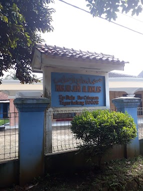
Mushola Al - Islamiyah
Jl. Setapak, No. 60, Tajur Halang, Citayam, Bogor, Jawa Barat 16320, Indonesia
contacts phone
:
+62
Latitude:
-6.4400737
, Longitude:
106.7584114
larger map & directions
read more
nearest Mosque
160 m
mushola daarul amanah
Unnamed Road, Citayam
Mosque
read more
193 m
Masjid Al-Mujahidin
Jalan Kampung Bulu RT 01/04, Citayam
Mosque
read more
389 m
Masjid An-nafi
Jalan Kampung Kaliputih, Citayam
Mosque
read more
520 m
Masjid Jami Al Hidayah Kaliputih
Jalan Setapak No.109, Citayam
Mosque
read more
531 m
mushola daarul amanah
Jalan Kampung Bulu, Citayam
Mosque
read more
552 m
MASJID AL IKHLAS
Citayam
Mosque
read more
552 m
Masjid Jami Al Ikhlas
Jalan Raya Kampung Bulu, Citayam
Mosque
read more
691 m
Mushola Al-Aman
Pengasinan
Mosque
read more
858 m
Musholla Al Ittihad
Griya Prigi Sawangan, Bedahan
Mosque
read more
864 m
Mushola Nurul Huda
Bedahan
Mosque
read more
906 m
Mesjid Al Ikhlas
Jl. Gg. Kapuk, RT. 5 RW. 13, Pabuaran, Citayam
Mosque
read more
914 m
Musholah Al Barokah
gang haji ali rapi kaliputih rt 07/03, Jalan Tengah, Citayam
Mosque
read more
979 m
Masjid Jami Nurul Mustakim
Citayam
Mosque
read more
984 m
Masjid Baitul Arif
Pengasinan
Mosque
read more
1.046 km
Masjid Jami Arribathul Mukthashor
Jalan Prigi, Bedahan, Sawangan, Bedahan
Mosque
read more
1.081 km
Musholla Baiturrahman
Jalan Setapak No.28, Citayam
Mosque
read more
1.112 km
Masjid Jami Mambaul Irfan
Jalan Panggulan Blok Mushola No.6, Pengasinan
Mosque
read more
1.117 km
Surau Qutubul Amin Arco
Duren Seribu
Mosque
read more
1.424 km
Masjid Ar-Riyadh
No., Jalan Masjid Ar-Riyadh No.43, Bedahan
Mosque
read more
1.597 km
Musholla Nurul Iman
Jalan Setapak No.43, Ragajaya
Mosque
read more
1.975 km
Musholla At-taqwa
Perigi RT 05/06, Bedahan
Mosque
read more
2.045 km
Musholla Al-Ikhlas
Blok K5, Jalan Puri Bukit Depok Blok G4 No.9, Sasak Panjang
Mosque
read more
2.07 km
Masjid Al Arinah
Alarinah, Jalan Duren Seribu, Duren Seribu
Mosque
read more
2.164 km
Masjid At Taqwa
Blok F28 RT01/06, Jalan Raya Inkopad, Kalisuren
Mosque
read more
2.442 km
Masjid ArRahmah
Jalan Parung Permata Indah Blok E1 No.26, RT.5/RW.12, Kalisuren
Mosque
read more
📑
all categories
Accounting
Administrative area level 1
Administrative area level 2
Airport
Amusement park
Aquarium
Art gallery
Atm
Bakery
Bank
Bar
Beauty salon
Bicycle store
Book store
Bowling alley
Bus station
Cafe
Campground
Car dealer
Car rental
Car repair
Car wash
Casino
Cemetery
Church
City hall
Clothing store
Colloquial area
Convenience store
Courthouse
Dentist
Department store
Doctor
Electrician
Electronics store
Embassy
Finance
Fire station
Florist
Food
Funeral home
Furniture store
Gas station
General contractor
Grocery or supermarket
Gym
Hair care
Hardware store
Health
Hindu Temple
Home goods store
Hospital
Insurance agency
Intersection
Jewelry store
Laundry
Lawyer
Library
Liquor store
Local government office
Locality
Locksmith
Lodging
Meal delivery
Meal takeaway
Mosque
Movie rental
Movie theater
Moving company
Museum
Natural feature
Neighborhood
Night club
Painter
Park
Parking
Pet store
Pharmacy
Physiotherapist
Place of worship
Plumber
Point of interest
Police
Political
Post office
Premise
Real estate agency
Restaurant
Roofing contractor
Route
Rv park, camping
School
Shoe store
Shopping mall
Spa
Stadium
Storage
Store
Subpremise
Supermarket
Synagogue
Taxi stand
Train station
Transit station
Travel agency
University
Veterinary care
Zoo
administrative area level 3
administrative area level 4
administrative area level 5
sublocality level 1
↑