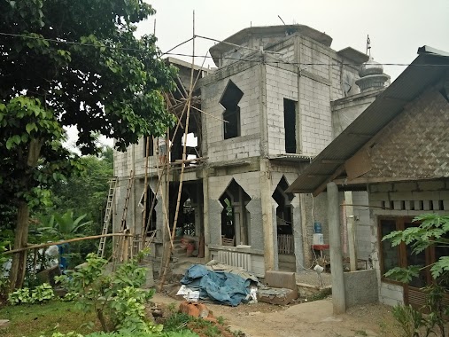
Mosque nearby Mesjid AL-HUDA
Indonesia
Mosque nearby Mesjid AL-HUDA
Mesjid AL-HUDA
Jalan Kenanga, Karang Asem Barat Indonesia
contacts phone
:
+62
Latitude:
-6.4912838
, Longitude:
106.8753149
read more
nearest Mosque
423 m
Masjid Al Ishlah
Gang Mesjid Karang Asem Timur, Karang Asem Timur
Mosque
read more
450 m
Masjid Asy-syakirin
West Karang Asem
Mosque
read more
458 m
Musholah Al-hidayah
Jalan Pahlawan No.100, Karang Asem Barat
Mosque
read more
652 m
Musolah Al-barokah
Puspanegara
Mosque
read more
659 m
Masjid Ponpes Mamba'ul Hikam
Gg. Dalam Maksan, Karang Asem Timur
Mosque
read more
684 m
Mushola Baitul Ni'mah Anwar
West Karang Asem
Mosque
read more
691 m
Majelis Ta'lim Al-falah
Jalan Pahlawan No.14, RT.05/RW.01, Karang Asem Barat
Mosque
read more
710 m
Masjid Besar Ash-Shohih
Jalan Pahlawan, Karang Asem Barat
Mosque
read more
714 m
Masjid Besar Ash-Shohih
West Karang Asem
Mosque
read more
717 m
Masjid As-Shoheh
Citerup, Puspanegara
Mosque
read more
873 m
Masjid Al Hidayah
Jl. Raya Mayor Oking, RT.01/RW.09, Puspasari, Citeureup, Puspasari
Mosque
read more
945 m
Masjid Falahul Faizin
Jalan Baru Puspa Negara No.49, Puspanegara
Mosque
read more
959 m
Masjid Al-Huda (PERSIS)
Jalan RE Sulaeman, Puspasari
Mosque
read more
1.007 km
Masjid Al Barokah
Jl Desa Puspa Negara No.25, Puspasari
Mosque
read more
1.041 km
MESJID NURUL HIDAYAH
West Karang Asem
Mosque
read more
1.069 km
Musholla SPBU
SPBU, Jalan Tajur, Citeureup
Mosque
read more
1.129 km
Masjid Al Furqon
Unnamed Road, 16810, Puspasari
Mosque
read more
1.201 km
Masjid Yohana Alam Triple J
West Karang Asem
Mosque
read more
1.232 km
Masjid Jami Nurul Iman
Jalan Desa Puspa Negara, Puspanegara
Mosque
read more
1.463 km
Masjid Al-Ashr
Puspasari
Mosque
read more
1.516 km
LDII Sanja
Jalan Pahlawan Blok Tanuwija 3 No.39, Sanja
Mosque
read more
1.814 km
Masjid Al Huda
Jalan Karanggan Btn Pos Kecamatan Citeureup, Puspasari
Mosque
read more
2.003 km
Masjid Jami Sabilul Huda
Jalan Desa Tarikolot, Citeureup
Mosque
read more
2.579 km
Masjid Al-Mansur
Kelurahan Pabuaran, RT 02 RW 07, Cibinong, Cirimekar
Mosque
read more
2.617 km
Masjid Al-wustho
Jalan Lang Bau Blok Belingbing No.37, Leuwinutug
Mosque
read more
📑
all categories
Accounting
Administrative area level 1
Administrative area level 2
Airport
Amusement park
Aquarium
Art gallery
Atm
Bakery
Bank
Bar
Beauty salon
Bicycle store
Book store
Bowling alley
Bus station
Cafe
Campground
Car dealer
Car rental
Car repair
Car wash
Casino
Cemetery
Church
City hall
Clothing store
Colloquial area
Convenience store
Courthouse
Dentist
Department store
Doctor
Electrician
Electronics store
Embassy
Finance
Fire station
Florist
Food
Funeral home
Furniture store
Gas station
General contractor
Grocery or supermarket
Gym
Hair care
Hardware store
Health
Hindu Temple
Home goods store
Hospital
Insurance agency
Intersection
Jewelry store
Laundry
Lawyer
Library
Liquor store
Local government office
Locality
Locksmith
Lodging
Meal delivery
Meal takeaway
Mosque
Movie rental
Movie theater
Moving company
Museum
Natural feature
Neighborhood
Night club
Painter
Park
Parking
Pet store
Pharmacy
Physiotherapist
Place of worship
Plumber
Point of interest
Police
Political
Post office
Premise
Real estate agency
Restaurant
Roofing contractor
Route
Rv park, camping
School
Shoe store
Shopping mall
Spa
Stadium
Storage
Store
Subpremise
Supermarket
Synagogue
Taxi stand
Train station
Transit station
Travel agency
University
Veterinary care
Zoo
administrative area level 3
administrative area level 4
administrative area level 5
sublocality level 1
↑