Mosque nearby Masjid Uswatun Hasanah
Indonesia
Mosque nearby Masjid Uswatun Hasanah
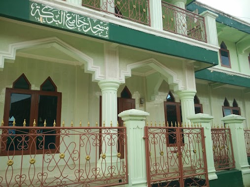
Masjid Uswatun Hasanah
Jalan Mushollah Al-Mukhtar, Cibitung Tengah Indonesien
contacts phone
:
+62
Latitude:
-6.6222142
, Longitude:
106.6910451
read more
nearest Mosque
371 m
Masjid Fuhaid Al-Kholaf
Central Cibitung
Mosque
read more
459 m
Masjid Jami Nurul Huda
Central Cibitung
Mosque
read more
670 m
MASJID NURUL AMAL
Central Cibitung
Mosque
read more
724 m
Nurul Hidayah Mosque
Central Cibitung
Mosque
read more
939 m
Jami Masjid Al-Hidayah
Tapos II
Mosque
read more
967 m
Masjid Jami Al-Istiqomah
Tapos II
Mosque
read more
1.226 km
Mushola Nurul Mubbin
Unnamed Road, 16810, Cibening
Mosque
read more
1.312 km
Masjid Abdul Fatah
Jalan Adbul Fatah No.24, Tapos II
Mosque
read more
1.359 km
Masjid Jami Pasar Salasa
No., Jalan Raya Cikampak No.64, Ciampea Udik
Mosque
read more
1.364 km
MUSOLA AL-BAROKAH
Jalan Adbul Fatah, Tapos II
Mosque
read more
1.464 km
Musholla Al- Ma'unah
Tapos II
Mosque
read more
1.476 km
Masjid Darussalam
Jalan Abdul Fatah, Tapos II
Mosque
read more
1.476 km
Masjid Darussalam
Jalan Adbul Fatah, Tapos II
Mosque
read more
1.492 km
Mushola Nurul Hasanah
Central Cibitung
Mosque
read more
1.494 km
Musolah Istiqomah
Central Cibitung
Mosque
read more
1.65 km
Mushola Al-Ikhlas
Ciampea Udik
Mosque
read more
1.735 km
masjid jami AL-AMIN
Gunung Malang
Mosque
read more
1.861 km
Masjid At Taufiq
Kampung Cisalada, RT 01/RW 05 Desa, Ciampea Udik
Mosque
read more
2.046 km
Mushalah Nurul Iman Al-firmani
Situ Daun
Mosque
read more
2.242 km
MASJID JAMI AL-IKHLAS
Ciampea Udik
Mosque
read more
2.272 km
Masjid Jami Al Barokah
Jalan Cigola, Ciaruteun Udik
Mosque
read more
2.445 km
Masjid Nurul Falah
Jalan Raya Tanjakan Cinangneng No.1, Cinangneng, Ciampea, Cinangneng
Mosque
read more
2.52 km
Masjid Jami' Nurul Falah
Jalan Cinangneng Bangkilung, Cinangneng
Mosque
read more
2.586 km
Masjid Daarussa'adah
Jalan Raya Layung Sari, Ciaruteun Udik
Mosque
read more
2.638 km
Mushola Nurul Hikmah
Cinangneng
Mosque
read more
📑
all categories
Accounting
Administrative area level 1
Administrative area level 2
Airport
Amusement park
Aquarium
Art gallery
Atm
Bakery
Bank
Bar
Beauty salon
Bicycle store
Book store
Bowling alley
Bus station
Cafe
Campground
Car dealer
Car rental
Car repair
Car wash
Casino
Cemetery
Church
City hall
Clothing store
Colloquial area
Convenience store
Courthouse
Dentist
Department store
Doctor
Electrician
Electronics store
Embassy
Finance
Fire station
Florist
Food
Funeral home
Furniture store
Gas station
General contractor
Grocery or supermarket
Gym
Hair care
Hardware store
Health
Hindu Temple
Home goods store
Hospital
Insurance agency
Intersection
Jewelry store
Laundry
Lawyer
Library
Liquor store
Local government office
Locality
Locksmith
Lodging
Meal delivery
Meal takeaway
Mosque
Movie rental
Movie theater
Moving company
Museum
Natural feature
Neighborhood
Night club
Painter
Park
Parking
Pet store
Pharmacy
Physiotherapist
Place of worship
Plumber
Point of interest
Police
Political
Post office
Premise
Real estate agency
Restaurant
Roofing contractor
Route
Rv park, camping
School
Shoe store
Shopping mall
Spa
Stadium
Storage
Store
Subpremise
Supermarket
Synagogue
Taxi stand
Train station
Transit station
Travel agency
University
Veterinary care
Zoo
administrative area level 3
administrative area level 4
administrative area level 5
sublocality level 1
↑