Mosque nearby Masjid Nurul Amal pabuaran indah
Indonesia
Mosque nearby Masjid Nurul Amal pabuaran indah
Masjid Nurul Amal pabuaran indah
1, Jalan Anggrek 1, 16916, Bogor, Jawa Barat, ID Indonesia
contacts phone
:
+62
Latitude:
-6.4465613
, Longitude:
106.8488515
larger map & directions
read more
nearest Mosque
248 m
Majlis Ta'lim Da'arul Fudhola
Jalan Pedurenan, Pabuaran
Mosque
read more
249 m
Masjid Al Khairat
Jalan Pedurenan, Pabuaran
Mosque
read more
253 m
Masjid Al-Ishlah Rw 018 Pabuaran Aari
Asri Rw 018, Jalan Perhubungan Raya, Pabuaran
Mosque
read more
270 m
Mushola Al Hijaz
Jalan Bougenvil Raya, Pabuaran
Mosque
read more
304 m
Mushola Pekapuran
Jalan Pekapuran, Pabuaran
Mosque
read more
366 m
Masjid Nurul Iman Kampung Padurenan, Pabuaran Mekar, Cibinong, Bogor
Pabuaran
Mosque
read more
424 m
Mushola Miftahul Jannah Pabuaran
Unnamed Road, Pabuaran
Mosque
read more
591 m
Masjid Al Ikhlas
Jl. H Syarif, Rt 03 Rw 02, Kalibaru
Mosque
read more
634 m
Masjid Jami'e Al-Muthabaqoh
Jalan Raya Bogor, Pabuaran
Mosque
read more
646 m
musollah silaturrahmi
Jl. Kp. Padurenan, Blok A4 No.38, Cibinong, Pabuaran
Mosque
read more
749 m
Masjid Assadiyah
Cilangkap
Mosque
read more
771 m
Masjid Al-Muchlisin
Jalan Kapling Arafat No.128, Cilangkap
Mosque
read more
783 m
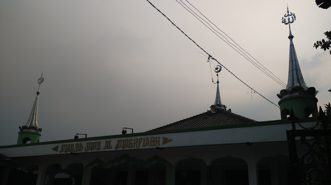
Masjid Jami Al Maghfiroh
Jalan Kampung Nyencle, Cilangkap
Mosque
read more
808 m
masjud ldii nur baitussifa
Kpg bedahan, RT.04/RW.02, pabuaran mekar
Mosque
read more
835 m
Musholla Al Hidayah
Kalibaru
Mosque
read more
929 m
MASJID LDII BAITUL MANSHURIN
Pabuaran
Mosque
read more
936 m
musholla baiturrahman
Jalan Kampung Bedahan No.80, Kalibaru
Mosque
read more
956 m
Mushola Al Inayah
Jalan H. Abdul Gani Raya No.58 Rt 01/02, Kalibaru
Mosque
read more
963 m
Masjid Islamadina
Jalan Griya Kalibaru, Harapan Jaya
Mosque
read more
999 m
Mushola Al Barokah
Jalan Abdul Gani Raya RT.06/RW.01, Kalibaru
Mosque
read more
1.001 km
Masjid Al Ikhwan
Jalan Kelurahan Pabuaran No.2, Pabuaran
Mosque
read more
1.065 km
Masjid Attawwabiin
Jalan Cilangkap No.8, Cilangkap
Mosque
read more
1.192 km
Musolah Almuhajirin
Cilangkap
Mosque
read more
1.196 km
Musholla Al Ikhlas
Jalan Raya Kemang RT.01/RW.10, Harapan Jaya
Mosque
read more
1.368 km
Masjid Jami At-Taubah
Jalan Masjid Al-Abror No.61, RT.1/RW.2, Cilangkap
Mosque
read more
📑
all categories
Accounting
Administrative area level 1
Administrative area level 2
Airport
Amusement park
Aquarium
Art gallery
Atm
Bakery
Bank
Bar
Beauty salon
Bicycle store
Book store
Bowling alley
Bus station
Cafe
Campground
Car dealer
Car rental
Car repair
Car wash
Casino
Cemetery
Church
City hall
Clothing store
Colloquial area
Convenience store
Courthouse
Dentist
Department store
Doctor
Electrician
Electronics store
Embassy
Finance
Fire station
Florist
Food
Funeral home
Furniture store
Gas station
General contractor
Grocery or supermarket
Gym
Hair care
Hardware store
Health
Hindu Temple
Home goods store
Hospital
Insurance agency
Intersection
Jewelry store
Laundry
Lawyer
Library
Liquor store
Local government office
Locality
Locksmith
Lodging
Meal delivery
Meal takeaway
Mosque
Movie rental
Movie theater
Moving company
Museum
Natural feature
Neighborhood
Night club
Painter
Park
Parking
Pet store
Pharmacy
Physiotherapist
Place of worship
Plumber
Point of interest
Police
Political
Post office
Premise
Real estate agency
Restaurant
Roofing contractor
Route
Rv park, camping
School
Shoe store
Shopping mall
Spa
Stadium
Storage
Store
Subpremise
Supermarket
Synagogue
Taxi stand
Train station
Transit station
Travel agency
University
Veterinary care
Zoo
administrative area level 3
administrative area level 4
administrative area level 5
sublocality level 1
↑