Mosque nearby masjid annur
Coronavirus disease (COVID-19) Situation
confirmed cases
6829221
deaths
162063
Indonesia
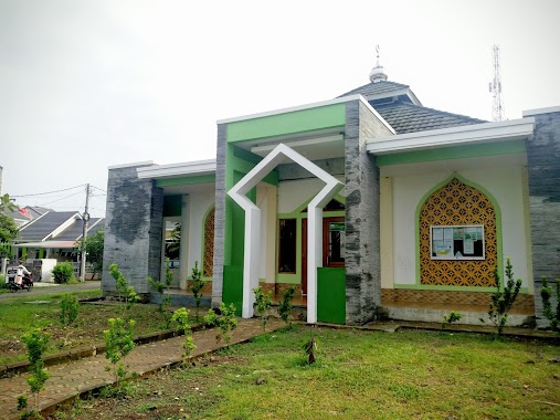
Mosque nearby masjid annur
masjid annur
Pasir Jambu Indonesien
contacts phone
:
+62
Latitude:
-6.5301963
, Longitude:
106.8173093
read more
nearest Mosque
290 m
Masjid Jami Nurul Iman
Jalan Raya Kampung Kaum Pandak No.13, Karadenan
Mosque
read more
366 m
Musola Alhasaniah
Pasir Jambu
Mosque
read more
467 m
Masjid Asyifa'urrahmah
Jalan Raya Cimandala No.9, Cimandala
Mosque
read more
492 m
Musholla Mulia Asrij
Pasir Jambu
Mosque
read more
549 m
Mushola Al Ikhlas
Jalan Raya Cimandala, Cimandala
Mosque
read more
607 m
Mushola Al Muhajirin
Cibinong, Graha Pandak Permai Block AA, Karadenan
Mosque
read more
639 m
Masjid LDII Karadenan
Jalan Raya Kampung Kaum Pandak No.10, Karadenan
Mosque
read more
720 m
Majelis Ilmu Al Fathan Al Ajim
Karadenan
Mosque
read more
774 m
Mesjid At Taqwa
Jalan Mandala Raya No.85, Cimandala
Mosque
read more
836 m
Majelis Taklim (MT) Hubbusalam
Pasir Jambu
Mosque
read more
850 m
Musholla An Nur
kp kebon rumput rt 05 rw 03, Pasir Jambu
Mosque
read more
869 m
Masjid Jami Al Marhamah
Jalan Raya Pemda Karadenan Km.4, kaumpandak, Cibinong, Karadenan, Cibinong, Karadenan
Mosque
read more
875 m
masjid Al Badriyah
Gang Mushola No.29, Karadenan
Mosque
read more
1.026 km
Masji Al Mujahidin
Karadenan
Mosque
read more
1.074 km
Musholah Nurul Iman
Cimandala
Mosque
read more
1.167 km
Masjid Jami Nurul Fallah
Jalan Raya Karadenan No.32, Karadenan
Mosque
read more
1.173 km
Masjid Baitul Maqdis VBI 5
Jalan Villa Bogor Indah V, Pasir Jambu
Mosque
read more
1.227 km
Masjid Nurul Falah
Cimandala
Mosque
read more
1.28 km
Masjid Pangkalan3 Pasir Jambu
Jalan Swadaya No.42, Pasir Jambu
Mosque
read more
1.4 km
Mesjid Al-Ihsan
Jalan Cimandala Raya No.6, Cimandala
Mosque
read more
1.757 km
Masjid Jami Kaum Hubbussalam
Jalan Kampung Kaum No.7, Ciparigi
Mosque
read more
1.764 km
Masjid Nurul Hasan
Jalan Raya Bogor, Cijujung
Mosque
read more
1.769 km
Masjid Alatiqiyah Karadenan
Jalan Kaumpandak 1, Karadenan
Mosque
read more
2.116 km
Masjid Al Barokah
Jalan Roda Pembangunan No.8, Nanggewer
Mosque
read more
2.552 km
Masjid Al-fudhola
Jalan Alternatif GOR Pemda No.140, Nanggewer
Mosque
read more
📑
all categories
Accounting
Administrative area level 1
Administrative area level 2
Airport
Amusement park
Aquarium
Art gallery
Atm
Bakery
Bank
Bar
Beauty salon
Bicycle store
Book store
Bowling alley
Bus station
Cafe
Campground
Car dealer
Car rental
Car repair
Car wash
Casino
Cemetery
Church
City hall
Clothing store
Colloquial area
Convenience store
Courthouse
Dentist
Department store
Doctor
Electrician
Electronics store
Embassy
Finance
Fire station
Florist
Food
Funeral home
Furniture store
Gas station
General contractor
Grocery or supermarket
Gym
Hair care
Hardware store
Health
Hindu Temple
Home goods store
Hospital
Insurance agency
Intersection
Jewelry store
Laundry
Lawyer
Library
Liquor store
Local government office
Locality
Locksmith
Lodging
Meal delivery
Meal takeaway
Mosque
Movie rental
Movie theater
Moving company
Museum
Natural feature
Neighborhood
Night club
Painter
Park
Parking
Pet store
Pharmacy
Physiotherapist
Place of worship
Plumber
Point of interest
Police
Political
Post office
Premise
Real estate agency
Restaurant
Roofing contractor
Route
Rv park, camping
School
Shoe store
Shopping mall
Spa
Stadium
Storage
Store
Subpremise
Supermarket
Synagogue
Taxi stand
Train station
Transit station
Travel agency
University
Veterinary care
Zoo
administrative area level 3
administrative area level 4
administrative area level 5
sublocality level 1
↑