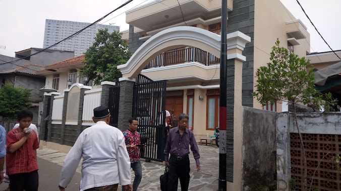
Mosque nearby Majelis Taklim Al Furqon
Coronavirus disease (COVID-19) Situation
confirmed cases
6829221
deaths
162063
Indonesia
Mosque nearby Majelis Taklim Al Furqon
Majelis Taklim Al Furqon
25, Jalan Cikini Kramat, 10320, Kota Jakarta Pusat, Daerah Khusus Ibukota Jakarta, ID Indonesia
contacts phone
:
+62
Latitude:
-6.1969357
, Longitude:
106.8422788
larger map & directions
read more
nearest Mosque
102 m
Masjid Cilosari
Jalan Cilosari No.17
Mosque
read more
311 m
Masjid As Syifa RSCM
RT.7/RW.1, Pegangsaan
Mosque
read more
387 m
Musholla Metropole
Metropole, Jl. Diponegoro No. 59, Pegangsaan, RT.1/RW.1, Pegangsaan
Mosque
read more
434 m
Masjid Al-musyarafah
RT.7/RW.2, Gondangdia
Mosque
read more
500 m
Musholla RSCM Lt.1
Jalan Pangeran Diponegoro No.19, RW.5, Kenari
Mosque
read more
502 m
Musholla Al Islah
Jalan Kenari I No.270, RT.13/RW.4, Kenari
Mosque
read more
580 m
Masjid As Saidi
Jalan Kenari I No.80, RT.9/RW.3, Kenari
Mosque
read more
641 m
Masjid Al-Makmur
Jalan Raden Saleh Raya No.30, RT.1/RW.4, Cikini
Mosque
read more
651 m
Masjid Jami' Cikini Al Ma'mur
Jalan Raden Saleh Raya No.30, RT.3/RW.3, Cikini
Mosque
read more
768 m
Masjid Jami' Al-Jama'ah
JL. Anyer, No. 5 Rt. 05 Rw. 02, Menteng, RT.6/RW.2, Menteng
Mosque
read more
776 m
Attauhid Arh - UI
Indonesien
Mosque
read more
904 m
Masjid Al Burhan
Jl. Menteng Sukabumi, RT. 04 / 03, Menteng, RT.3/RW.3, Menteng
Mosque
read more
919 m
MASJID JAMI AL-JAMAAH
Jalan Anyer Gang 9 No.36 RT.5, Menteng, RT.10/RW.2, Menteng
Mosque
read more
927 m
Mesjid Al Huda
JL Tole Iskandar, RT.10/RW.7, Menteng
Mosque
read more
942 m
Masjid Darul 'Ulum
Jalan Salemba Raya No.18, RT.3/RW.6, Kenari
Mosque
read more
943 m
Ahmad Yani Mosque
Jalan Lembang No.56A, RT.11/RW.7, Menteng
Mosque
read more
956 m
Masjid Yamp - Menteng
RSUP Cipto Mangunkusumo, Pegangsaan, Menteng, RT.7/RW.3, Pegangsaan
Mosque
read more
993 m
Musholla Al Hikmah
Jalan Kramat 5 No.14, RT.3/RW.9, Kenari
Mosque
read more
1.032 km
Masjid Jami Tawakkal
Jalan Menteng Jaya No.16, RT.16/RW.9, Menteng
Mosque
read more
1.039 km
Masjid LDII AL-ISTIQOMAH
No, Jalan Kali Pasir Guru Demar No.8, RT.4/RW.1, Cikini
Mosque
read more
1.046 km
Masjid Asy - Syifa
Jalan Tambak 2 No.8, RT.8/RW.5, Pegangsaan
Mosque
read more
1.109 km
Masjid Ma' Rifat
Jalan Lembang Terusan RT.11/RW.7, Menteng
Mosque
read more
1.143 km
Yayasan Masjid Jami Matraman
Jalan Matraman Masjid No.2, RT.2/RW.7, Pegangsaan
Mosque
read more
1.237 km
Masjid Jami' Matraman
RT.8/RW.4, Pegangsaan, Menteng
Mosque
read more
1.26 km
Mushola Baiturrahim (H.Rais)
Jalan Kramat Lontar 6 Blok J No.136, RT.7/RW.1, Paseban
Mosque
read more
📑
all categories
Accounting
Administrative area level 1
Administrative area level 2
Airport
Amusement park
Aquarium
Art gallery
Atm
Bakery
Bank
Bar
Beauty salon
Bicycle store
Book store
Bowling alley
Bus station
Cafe
Campground
Car dealer
Car rental
Car repair
Car wash
Casino
Cemetery
Church
City hall
Clothing store
Colloquial area
Convenience store
Courthouse
Dentist
Department store
Doctor
Electrician
Electronics store
Embassy
Finance
Fire station
Florist
Food
Funeral home
Furniture store
Gas station
General contractor
Grocery or supermarket
Gym
Hair care
Hardware store
Health
Hindu Temple
Home goods store
Hospital
Insurance agency
Intersection
Jewelry store
Laundry
Lawyer
Library
Liquor store
Local government office
Locality
Locksmith
Lodging
Meal delivery
Meal takeaway
Mosque
Movie rental
Movie theater
Moving company
Museum
Natural feature
Neighborhood
Night club
Painter
Park
Parking
Pet store
Pharmacy
Physiotherapist
Place of worship
Plumber
Point of interest
Police
Political
Post office
Premise
Real estate agency
Restaurant
Roofing contractor
Route
Rv park, camping
School
Shoe store
Shopping mall
Spa
Stadium
Storage
Store
Subpremise
Supermarket
Synagogue
Taxi stand
Train station
Transit station
Travel agency
University
Veterinary care
Zoo
administrative area level 3
administrative area level 4
administrative area level 5
sublocality level 1
↑