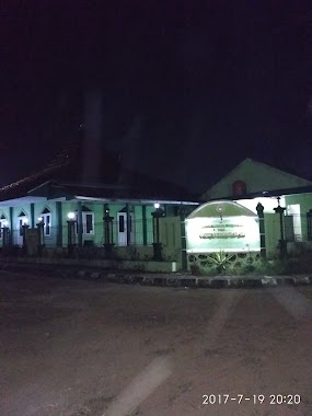
Mosque nearby Jami Masjid At-Taqwa
Indonesia
Mosque nearby Jami Masjid At-Taqwa
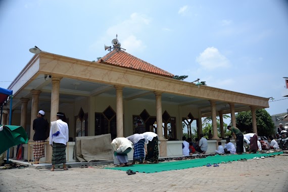
Jami Masjid At-Taqwa
kp.Lamporan Desa Pangadegan pasar kemis, Sukamantri, PasarKemis, Tangerang, Banten 15560, Indonesien
contacts phone
:
+62
Latitude:
-6.151359
, Longitude:
106.5515712
larger map & directions
read more
nearest Mosque
171 m
Mushola AL Ikhlas Cluster Udayana RW020
Sukamantri
Mosque
read more
426 m
Masjid JAMI Albarokah
Jalan Dahlia V, Sukamantri
Mosque
read more
741 m
Mushola AT-TAQWA
Jalan Perum Bumi Indah Blok GD No.5A, Sukamantri
Mosque
read more
793 m
Mesjid Kp. Ilat Pangadegan
Pangadegan, PasarKemis, Pangadegan
Mosque
read more
794 m
Masjid Bumi Indah Tahap 3 pasar kemis
Jalan Cempaka VIII Blok HE No.11, Sukamantri
Mosque
read more
809 m
Masjid Jami Al- Muttaqin
Kp. Pabuaran, Sukamantri, Pangadegan, Pasar Kemis, Sukamantri
Mosque
read more
813 m
Al-Muttaqien
Jalan Raya Cadas - Kukun No.88, Pangadegan
Mosque
read more
831 m
Masjid Al Iman
Jalan Merpati Modena 7 Blok AC23 No.23, Sukamantri
Mosque
read more
839 m
Masjid Pesantren Modern Daarul Mutaqien
Jalan Raya Cadas - Kukun No.88, Pangadegan
Mosque
read more
864 m
Mushola Hidayatulloh
Jalan Perum Puri Jaya Taman Permai, Sukamantri
Mosque
read more
894 m
Musholla Baitussalam
Jl. Chrysant XI Blok GC1 RT 05 RW 09,, Sukamantri
Mosque
read more
902 m
Masjid Al Muhajirin
Pangadegan, PasarKemis, Pangadegan
Mosque
read more
934 m
Masjid Daarul Muttaqien II
Pangadegan
Mosque
read more
963 m
Masjid Fatimah Al Ali
Jalan Merpati Jacobin 5 Blok AD6 No.26, Sukamantri
Mosque
read more
1.02 km
Masjid Al-Ikhlas
Jalan Bougenville Bumi Indah Thp 2, Pasar Kemis, Tangerang 15560, Sukamantri
Mosque
read more
1.205 km
Masji AL - Wustho
Jalan Nn Blok BA4 No.28, Kutabumi
Mosque
read more
1.215 km
Mushola Al- Hidayah
4,, Jalan Kota Baru Agung Residence 3, Sindangsari
Mosque
read more
1.217 km
Masjid Jami' Al Muhajirin Taman Buah Sukamantri
Sukamantri
Mosque
read more
1.228 km
Masjid Al Ikhlas Taman Buah
Kutabumi
Mosque
read more
1.842 km
Mushola Al Mu'min
Kutabumi
Mosque
read more
1.936 km
mesjid almujadid
Jalan Raya Bumi Indah, Gelam Jaya
Mosque
read more
1.968 km
Masjid An-Nur
Sindangsari
Mosque
read more
1.978 km
Masjid Al Istiqlaliyah
No., Jalan Pesantren No.16, Sukamantri
Mosque
read more
2.333 km
Masjid Kenari Asri
53-, Jalan Nn Blok AB No.62, Gelam Jaya
Mosque
read more
2.337 km
Musolah Al-muqomah
Jalan Nn Blok FD8 No.53, Gelam Jaya
Mosque
read more
📑
all categories
Accounting
Administrative area level 1
Administrative area level 2
Airport
Amusement park
Aquarium
Art gallery
Atm
Bakery
Bank
Bar
Beauty salon
Bicycle store
Book store
Bowling alley
Bus station
Cafe
Campground
Car dealer
Car rental
Car repair
Car wash
Casino
Cemetery
Church
City hall
Clothing store
Colloquial area
Convenience store
Courthouse
Dentist
Department store
Doctor
Electrician
Electronics store
Embassy
Finance
Fire station
Florist
Food
Funeral home
Furniture store
Gas station
General contractor
Grocery or supermarket
Gym
Hair care
Hardware store
Health
Hindu Temple
Home goods store
Hospital
Insurance agency
Intersection
Jewelry store
Laundry
Lawyer
Library
Liquor store
Local government office
Locality
Locksmith
Lodging
Meal delivery
Meal takeaway
Mosque
Movie rental
Movie theater
Moving company
Museum
Natural feature
Neighborhood
Night club
Painter
Park
Parking
Pet store
Pharmacy
Physiotherapist
Place of worship
Plumber
Point of interest
Police
Political
Post office
Premise
Real estate agency
Restaurant
Roofing contractor
Route
Rv park, camping
School
Shoe store
Shopping mall
Spa
Stadium
Storage
Store
Subpremise
Supermarket
Synagogue
Taxi stand
Train station
Transit station
Travel agency
University
Veterinary care
Zoo
administrative area level 3
administrative area level 4
administrative area level 5
sublocality level 1
↑