Mosque nearby Az Zahra Mosque - Aminah Hospital
Coronavirus disease (COVID-19) Situation
confirmed cases
6829221
deaths
162063
Indonesia
Mosque nearby Az Zahra Mosque - Aminah Hospital
Az Zahra Mosque - Aminah Hospital
17, Jalan Pesantren, 15156, Kota Tangerang, Banten, ID Indonesia
contacts phone
:
+62
Latitude:
-6.2375078
, Longitude:
106.7447788
larger map & directions
read more
nearest Mosque
146 m
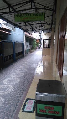
Mushola At-Taqwa
Jalan Pesantren I, Kreo Selatan
Mosque
read more
150 m
Musholla Al-Muhajirin
Jalan Bahagia No. 2, Kereo Selatan, Larangan, Kreo Selatan
Mosque
read more
333 m
Masjid Al Mamur,
Jalan Pesantren I No.29, Kreo Selatan
Mosque
read more
338 m
Masjid Al Kautsar
Jalan Haji Muchtar Raya No.1, RW.11, Petukangan Utara
Mosque
read more
404 m
Masjid Jami Al Mujahidin
Jalan Haji Sulaiman No.67, RT.3/RW.1, Petukangan Utara
Mosque
read more
425 m
Masjid Jami Riyadhus Sholihin
Jalan Haji Najih No.47, Kreo Selatan
Mosque
read more
544 m
Masjid At Taqwa
Jalan H. Muchtar Raya, Petukangan Utara, Larangan, RW.1, Kreo
Mosque
read more
562 m
Masjid Jami' Tugasku
RT.11/RW.2, Petukangan Utara
Mosque
read more
590 m
MASKI JAMIE DAARUL MA'WA KREO SELTAN
Jalan Pemuda No.8, Kreo Selatan
Mosque
read more
659 m
Masjid Al Abror
Jalan Haji Gaim, Rt.5/Rw.2, Petukangan Utara, Pesanggrahan, RT.5/RW.2, Petukangan Utara
Mosque
read more
666 m
Masjid Baitullah
Jalan Haji Sulaiman No.66, RT.11/RW.1, Petukangan Utara
Mosque
read more
714 m
Masjid Jami Baitut Taqwa
Jalan Sabar Raya RT.2/RW.3, Petukangan Selatan
Mosque
read more
788 m
Mushalla Al-ikhlas
Jalan Lestari No.63B, Kreo Selatan
Mosque
read more
861 m
Masjid At-Taubah
Jalan Ciledug Raya RT.1/RW.3, Petukangan Selatan
Mosque
read more
888 m
Masjid Al Istiqomah
Jalan Istiqomah No.57, Cipadu
Mosque
read more
943 m
Musholla Al-Ikhlas
Jalan Haji Radien RT.6/RW.3, Petukangan Utara
Mosque
read more
947 m
Masjid Jami Baiturrahman Al-Haq
Indonesia
Mosque
read more
964 m
Masjid Al Ikhlas Cipadu
Gang Nila 2 No.1, Cipadu
Mosque
read more
994 m
Masjid Jami Nurul Amal Sw
Jalan Bahagia 4 No. 6, Cipadu, Larangan, Cipadu
Mosque
read more
1.034 km
Musolah Ar Rahman
Jalan Haji Radin No.04, RT.10/RW.4, Petukangan Utara
Mosque
read more
1.039 km
Masjid Manbaul Khair
Jalan HOS Cokroaminoto, Kreo
Mosque
read more
1.066 km
Masjid Miftahunnur
Jalan AMD Manunggal V No.2, RT.6/RW.10, Petukangan Utara
Mosque
read more
1.179 km
Masjid Jami' Nurus Saadah
Jalan H.Muad No.23, Kreo
Mosque
read more
1.199 km
Masjid Al Ikhlas
JL Chairil Anwar, RT 02 RW 02, Larangan, Kreo
Mosque
read more
1.291 km
Masjid Al-Mubarok
Jalan Masjid Darul Fallah No.17 A, Petukangan Utara
Mosque
read more
📑
all categories
Accounting
Administrative area level 1
Administrative area level 2
Airport
Amusement park
Aquarium
Art gallery
Atm
Bakery
Bank
Bar
Beauty salon
Bicycle store
Book store
Bowling alley
Bus station
Cafe
Campground
Car dealer
Car rental
Car repair
Car wash
Casino
Cemetery
Church
City hall
Clothing store
Colloquial area
Convenience store
Courthouse
Dentist
Department store
Doctor
Electrician
Electronics store
Embassy
Finance
Fire station
Florist
Food
Funeral home
Furniture store
Gas station
General contractor
Grocery or supermarket
Gym
Hair care
Hardware store
Health
Hindu Temple
Home goods store
Hospital
Insurance agency
Intersection
Jewelry store
Laundry
Lawyer
Library
Liquor store
Local government office
Locality
Locksmith
Lodging
Meal delivery
Meal takeaway
Mosque
Movie rental
Movie theater
Moving company
Museum
Natural feature
Neighborhood
Night club
Painter
Park
Parking
Pet store
Pharmacy
Physiotherapist
Place of worship
Plumber
Point of interest
Police
Political
Post office
Premise
Real estate agency
Restaurant
Roofing contractor
Route
Rv park, camping
School
Shoe store
Shopping mall
Spa
Stadium
Storage
Store
Subpremise
Supermarket
Synagogue
Taxi stand
Train station
Transit station
Travel agency
University
Veterinary care
Zoo
administrative area level 3
administrative area level 4
administrative area level 5
sublocality level 1
↑