Lodging nearby Villa Parung
Coronavirus disease (COVID-19) Situation
confirmed cases
6829221
deaths
162063
Indonesia
Lodging nearby Villa Parung
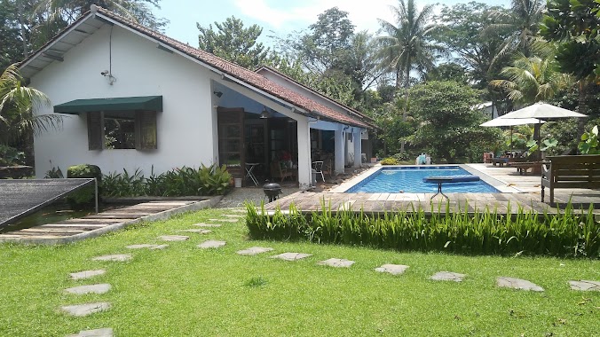
Villa Parung
7, Jalan Mesjid Al-Irfan, 16330, Bogor, Jawa Barat, ID Indonesien
contacts phone
:
+62
Latitude:
-6.4401673
, Longitude:
106.7282168
larger map & directions
read more
nearest Lodging
6 m
El Hoppo Private Venue
Jalan Mesjid Al-Irfan, Pemagarsari
Lodging
read more
555 m
Megah Jaya Citra Garmindo. PT
JL. Raya Parung Kuda, Km. 21, Parung Kuda
Lodging
read more
569 m
Kontrakan blok l
Gang Haji Minggoe, Pemagarsari
Lodging
read more
894 m
Pondok Pesantren Tahfidzul Quran WADIL MUBAROK
Pemagarsari
Lodging
read more
967 m
Majelis Dzikir Dan Shalawat Al Fatih
Jalan Toong, Pemagarsari
Lodging
read more
981 m
Dayen Lodge - Orchard Residences
Pemagarsari
Lodging
read more
1.062 km
Danau Kavling 3 Kemenko
Jabon Mekar
Lodging
read more
1.372 km
IRPI TAKIN Residence
Jalan Madroi, Parung
Lodging
read more
1.387 km
Griya Nusantara
Jalan Desa Jabon Mekar, Jabon Mekar
Lodging
read more
1.393 km
Rumah Yola Vitaloka
Jalan Sawangan Elok, Duren Seribu
Lodging
read more
1.425 km
Klinik Mukti Bhakti
Jalan Arco Raya No.31, Citayam
Lodging
read more
1.514 km
Madnur
Jalan Kampung Jati Parung, Waru
Lodging
read more
1.602 km
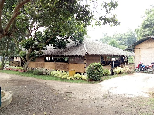
Padepokan Welas Asih
no 99,desa waru induk,,, Jalan Haji Mawi, Waru
Lodging
read more
1.61 km
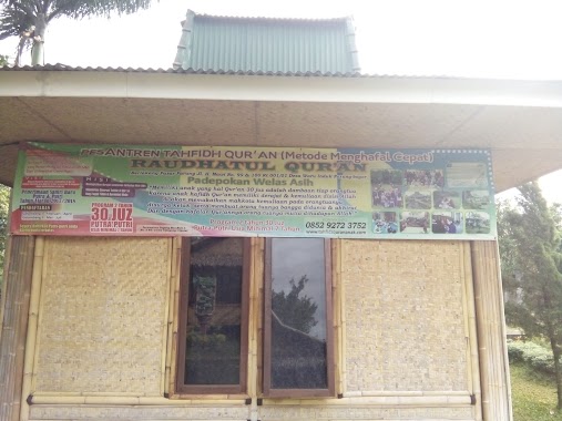
Pondok Pesantren Tahfidz Raudhatul Qur'an
Jalan Haji Mawi No.99, RT.001/RW.01, Waru
Lodging
read more
1.615 km
Hotel Parung Transit
Jalan Raya Parung KM.40 No.88, Jabon Mekar
Lodging
read more
1.647 km
M Yatim
villa gading blok c no 10, Jabon Mekar
Lodging
read more
1.736 km
Warung Ilham
Gang Dadang-I No.9 RT 04/07, Warujaya
Lodging
read more
1.763 km
Kontrakan Aris
Jalan H.Abdullah No.5766, RT.2, Parung
Lodging
read more
1.905 km
Rayyan & Syifa House
de' Paris Residence, Jalan Daun Salam II No.8, Kalisuren
Lodging
read more
1.978 km
Bezun House
Blok D/A, Jalan Pasar Parung Blok D/A No.16, Waru
Lodging
read more
2.256 km
Ponpes Asyifa Al Islami
Warujaya
Lodging
read more
2.287 km
Home Azillah Syafira
Jalan Al-Kausar, Duren Seribu
Lodging
read more
2.313 km
Ajay camps
Jalan Kampung Kandang Duren Seribu, Duren Seribu
Lodging
read more
2.347 km
Ibu Titin/Listinah
jalan masjid Nurul iman No.37, RT.002/RW.003, Waru
Lodging
read more
2.766 km
Geocoded Address
Blok 15 No.13,, Jalan Perumahan Inkopad Blok E No.14, Sasak Panjang
Lodging
read more
📑
all categories
Accounting
Administrative area level 1
Administrative area level 2
Airport
Amusement park
Aquarium
Art gallery
Atm
Bakery
Bank
Bar
Beauty salon
Bicycle store
Book store
Bowling alley
Bus station
Cafe
Campground
Car dealer
Car rental
Car repair
Car wash
Casino
Cemetery
Church
City hall
Clothing store
Colloquial area
Convenience store
Courthouse
Dentist
Department store
Doctor
Electrician
Electronics store
Embassy
Finance
Fire station
Florist
Food
Funeral home
Furniture store
Gas station
General contractor
Grocery or supermarket
Gym
Hair care
Hardware store
Health
Hindu Temple
Home goods store
Hospital
Insurance agency
Intersection
Jewelry store
Laundry
Lawyer
Library
Liquor store
Local government office
Locality
Locksmith
Lodging
Meal delivery
Meal takeaway
Mosque
Movie rental
Movie theater
Moving company
Museum
Natural feature
Neighborhood
Night club
Painter
Park
Parking
Pet store
Pharmacy
Physiotherapist
Place of worship
Plumber
Point of interest
Police
Political
Post office
Premise
Real estate agency
Restaurant
Roofing contractor
Route
Rv park, camping
School
Shoe store
Shopping mall
Spa
Stadium
Storage
Store
Subpremise
Supermarket
Synagogue
Taxi stand
Train station
Transit station
Travel agency
University
Veterinary care
Zoo
administrative area level 3
administrative area level 4
administrative area level 5
sublocality level 1
↑