Lodging nearby KOST SARI AYU
Indonesia
Lodging nearby KOST SARI AYU
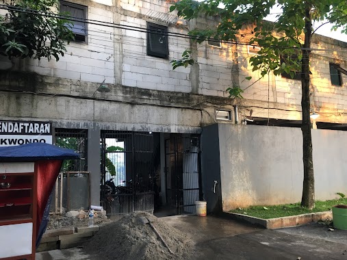
KOST SARI AYU
Unnamed Road, Setu Indonesia
contacts phone
:
+62
Latitude:
-6.3436543
, Longitude:
106.6772588
read more
nearest Lodging
51 m
PUSPITkkEK
Kampus ITI, Muncul
Lodging
read more
127 m
ARIE PRASETYO
Jalan Raya Puspitek Blok Adil No.20, Setu
Lodging
read more
175 m
Kost Jacinto
Setu
Lodging
read more
191 m
Kost Ibu Yumi
Unnamed Road
Lodging
read more
196 m
Kost latansa
Setu
Lodging
read more
252 m
Kost Putih
Jalan Gang Adil, Setu
Lodging
read more
261 m
Kost Griya Mitra
Jalan Raya Puspitek Blok Mesjid No.44, Setu
Lodging
read more
329 m
Wisma Rekna Jaya
Jalan Raya Puspiptek Blok Mesjid No.60, Setu
Lodging
read more
582 m
Kos Pak Jaya
Gang Haji Muhammad Sarta, Serpong, Setu
Lodging
read more
593 m
Kosan Sebelah Danau Setu
Setu
Lodging
read more
900 m
Kos Kosan Kang Medi
Kademangan
Lodging
read more
905 m
Dede Sahri
Jalan Hutama Karya, Kademangan
Lodging
read more
921 m
GUEST HOUSE
Jalan Wisma Tamu Puspiptek, Setu
Lodging
read more
923 m
Wisma Tamu Puspiptek
Jl. Kompleks Puspiptek, Setu
Lodging
read more
1.023 km
KONTRAKAN PAK BANING
Jalan Ajad No.16, Kademangan
Lodging
read more
1.03 km
Sayira Mefini
Jalan Raya Sengkol, Babakan
Lodging
read more
1.04 km
Podomoro Pavilion
Jalan Saikem Podomoro Pavilion No.4, Kademangan
Lodging
read more
1.057 km
Komplek ALARM
Kademangan
Lodging
read more
1.098 km
Kost D'Walet Blok A
Jl. H. Saikem RT.01/RW.02, Kademangan, Setu, Kademangan
Lodging
read more
1.106 km
Bukit Serpong Lestari
Jalan Hutama Karya, Muncul
Lodging
read more
1.495 km
wijaya&pinahomes
Kp. Sarimulya Rt.02/01, Setu
Lodging
read more
1.575 km
Indekos Bpk.Jenim
jl.lingkar selatan kp.sengkol Rt.05/002 No.66, Setu, Muncul
Lodging
read more
1.721 km
Kost Kurnia Mustika
Buaran, Serpong, Babakan
Lodging
read more
1.871 km
Rukos GNSC Batan Indah
Jalan Cirompang, Kademangan
Lodging
read more
1.989 km
Delatinos Cluster Brazillian
Setu
Lodging
read more
📑
all categories
Accounting
Administrative area level 1
Administrative area level 2
Airport
Amusement park
Aquarium
Art gallery
Atm
Bakery
Bank
Bar
Beauty salon
Bicycle store
Book store
Bowling alley
Bus station
Cafe
Campground
Car dealer
Car rental
Car repair
Car wash
Casino
Cemetery
Church
City hall
Clothing store
Colloquial area
Convenience store
Courthouse
Dentist
Department store
Doctor
Electrician
Electronics store
Embassy
Finance
Fire station
Florist
Food
Funeral home
Furniture store
Gas station
General contractor
Grocery or supermarket
Gym
Hair care
Hardware store
Health
Hindu Temple
Home goods store
Hospital
Insurance agency
Intersection
Jewelry store
Laundry
Lawyer
Library
Liquor store
Local government office
Locality
Locksmith
Lodging
Meal delivery
Meal takeaway
Mosque
Movie rental
Movie theater
Moving company
Museum
Natural feature
Neighborhood
Night club
Painter
Park
Parking
Pet store
Pharmacy
Physiotherapist
Place of worship
Plumber
Point of interest
Police
Political
Post office
Premise
Real estate agency
Restaurant
Roofing contractor
Route
Rv park, camping
School
Shoe store
Shopping mall
Spa
Stadium
Storage
Store
Subpremise
Supermarket
Synagogue
Taxi stand
Train station
Transit station
Travel agency
University
Veterinary care
Zoo
administrative area level 3
administrative area level 4
administrative area level 5
sublocality level 1
↑