Lodging nearby Asrama Haji Transit Palu Sulteng
Coronavirus disease (COVID-19) Situation
confirmed cases
6829221
deaths
162063
Indonesia
Lodging nearby Asrama Haji Transit Palu Sulteng
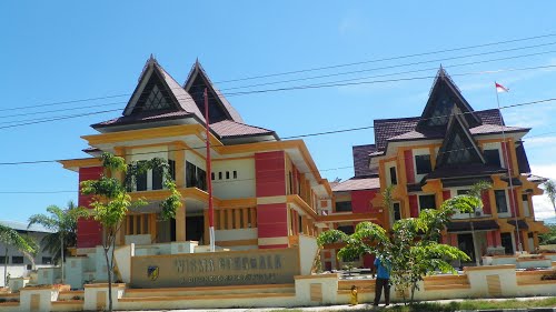
Asrama Haji Transit Palu Sulteng
Jalan WR Supratman No.7, Lere Indonesia
contacts phone
:
+62
Latitude:
-0.8943882
, Longitude:
119.8509797
read more
nearest Lodging
242 m
Mompesana
Jalan Cut Mutiah No.1, Kamonji
Lodging
read more
394 m
Mitra
Jalan Panjaitan No.12, Kamonji
Lodging
read more
394 m
Ratu
Kamonji
Lodging
read more
462 m
PT. Buluri Tabaro Inn
JL. Ruas Palu-donggala, Donggala Kodi
Lodging
read more
514 m
Asam II Lrg 1 Tembok Xl
Lere, Palu Barat, Lere
Lodging
read more
585 m
Mesh Pemda Donggala
No., Jalan Diponegoro No.43A, Lere
Lodging
read more
675 m
Kos Warna Warni Pak Rahmat
Unnamed Road, Lere
Lodging
read more
724 m
Hotel Buana Halim Putry
Jalan Nangka, Siranindi
Lodging
read more
728 m
Borneo House Palu
Jalan Mokolembake No.3, Palu Barat, Lere
Lodging
read more
738 m
penginapan ratu
Jalan Datu Pamusu, Kamonji
Lodging
read more
787 m
Kos Mentari
Lere
Lodging
read more
816 m
Niceplace PALU
no 43, Jalan H Agus Salim, Baru
Lodging
read more
955 m
Kos-Kosan Aluna
Lere
Lodging
read more
989 m
Wisma Putih
Jalan KyaiHaji Wahid Hasyim, Baru
Lodging
read more
993 m
Guest House Inda
Jalan HOS Cokroaminoto, Baru
Lodging
read more
1.004 km
Kost Anisa
Lere
Lodging
read more
1.044 km
Airy Siranindi Sis Al Jufri 17 Palu
Jalan Sis Aljufri No 17, Siranindi
Lodging
read more
1.047 km
Matahari Penginapan
JL KH Ahmad Dahlan No.11, Kamonji
Lodging
read more
1.056 km
Palu City Hotel
Siranindi
Lodging
read more
1.066 km
Ballroom Mercure Hotel
Jalan Cumi-Cumi No.8, Lere
Lodging
read more
1.104 km
Hamka.kupe
Jalan Mangga 1, Kamonji
Lodging
read more
1.181 km
Mess Donggala
Jalan Diponegoro, Lere
Lodging
read more
1.2 km
Hotel MMC
Siranindi
Lodging
read more
1.205 km
Alam Raya Hotel
Jalan Sis Aljufri No.72, Siranindi
Lodging
read more
2.014 km
TOTAL X
Jl. Raja Moili No. 45, Besusu Barat, Palu Timur, Besusu Barat
Lodging
read more
📑
all categories
Accounting
Administrative area level 1
Administrative area level 2
Airport
Amusement park
Aquarium
Art gallery
Atm
Bakery
Bank
Bar
Beauty salon
Bicycle store
Book store
Bowling alley
Bus station
Cafe
Campground
Car dealer
Car rental
Car repair
Car wash
Casino
Cemetery
Church
City hall
Clothing store
Colloquial area
Convenience store
Courthouse
Dentist
Department store
Doctor
Electrician
Electronics store
Embassy
Finance
Fire station
Florist
Food
Funeral home
Furniture store
Gas station
General contractor
Grocery or supermarket
Gym
Hair care
Hardware store
Health
Hindu Temple
Home goods store
Hospital
Insurance agency
Intersection
Jewelry store
Laundry
Lawyer
Library
Liquor store
Local government office
Locality
Locksmith
Lodging
Meal delivery
Meal takeaway
Mosque
Movie rental
Movie theater
Moving company
Museum
Natural feature
Neighborhood
Night club
Painter
Park
Parking
Pet store
Pharmacy
Physiotherapist
Place of worship
Plumber
Point of interest
Police
Political
Post office
Premise
Real estate agency
Restaurant
Roofing contractor
Route
Rv park, camping
School
Shoe store
Shopping mall
Spa
Stadium
Storage
Store
Subpremise
Supermarket
Synagogue
Taxi stand
Train station
Transit station
Travel agency
University
Veterinary care
Zoo
administrative area level 3
administrative area level 4
administrative area level 5
sublocality level 1
↑