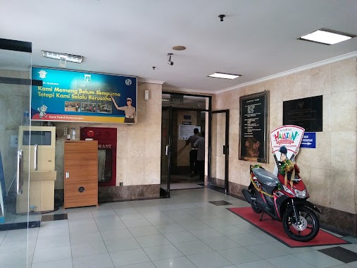
Local government office nearby Marulam Pandiangan, SH & Johny Nainggolan, SH
Indonesia
Local government office nearby Marulam Pandiangan, SH & Johny Nainggolan, SH
Marulam Pandiangan, SH & Johny Nainggolan, SH
Jalan Taman Palem Lestari Blok A11 No.3A, RT.5/RW.13, Cengkareng Barat Indonesia
contacts phone
:
+62
Latitude:
-6.1367235
, Longitude:
106.7220453
read more
nearest Local government office
319 m
Perum Taman Palm Lestari Blok B 10
perumahan taman palm lestari blok b 10 no 28 barat, RT.8/RW.13, Cengkareng Barat
Local government office
read more
564 m
Kantor pegacara ryder sitorus &rekan
Jalan Balikpapan No.3-4, Petojo Selatan, Gambir, RT.12/RW.10, Cengkareng Barat
Local government office
read more
644 m
Puskesmas Cengkareng Barat 1
Jalan Flamboyan No.77, RT.10/RW.8, Cengkareng Barat
Local government office
read more
746 m
Panti Sosial Tresna Werda 4 (PUM)
Jalan Rawa Bengkel No.36, Cengkareng Barat, Cengkareng, RT.8/RW.7, Cengkareng Barat
Local government office
read more
850 m
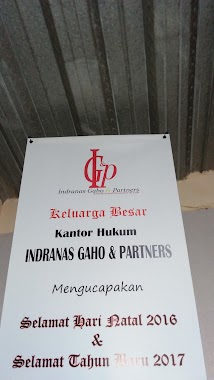
Law Office Indranas Gaho & Partners
RT.6/RW.17, Pegadungan
Local government office
read more
890 m
Komp Town House Blok Kk1
RT.2/RW.11, Pegadungan
Local government office
read more
968 m
Top Finance Cengkareng
Blok B 2, 6°08'08. 106°43'50., Ruko Poris Paradise RW.6, Cipondoh Indah
Local government office
read more
1.194 km
Law Office AGUS ASWANI, SH. & REKAN
Jalan Sumbawa Dalam RT.5/RW.6, Tegal Alur
Local government office
read more
1.241 km
Biro Jasa Nico
blok b3/, Jalan Permata Taman Palem RT.9/RW.3, Pegadungan
Local government office
read more
1.335 km
Klinik Cemara Medika
Jalan Cemara No.5B, RT.1/RW.1, Cengkareng Barat
Local government office
read more
1.358 km
Hasta Brata & Partners
Jalan Hawaiian City II No.86, RT.7/RW.14, Cengkareng Timur
Local government office
read more
1.451 km
Petra Gracia Kreasi
RT.2/RW.12, Cengkareng Barat
Local government office
read more
1.458 km
Kantor Kelurahan Pegadungan, Kec. Kalideres, Kodya Jakarta Barat
Jalan Palem Kuning Blok D10 No.10, RT.11/RW.13, Pegadungan
Local government office
read more
1.473 km
Komplek Permata Taman Palm
Jalan Permata Taman Palem RT.6/RW.3, Pegadungan
Local government office
read more
1.583 km
East Cengkareng Townhall
Jalan Fajar Baru Utara No.2, RT.1/RW.12, Cengkareng Timur, Cengkareng, RT.7/RW.8, RT.1/RW.9, Cengkareng Timur
Local government office
read more
1.584 km
Pos CITRA BHAYANGKARA tegal Alur
Jalan Prima 2 No.23, RT.9/RW.11, Tegal Alur
Local government office
read more
1.604 km
PT.Coshano Mandala Semesta
Ruko Daan Mogot Baru Blok KJD No.34, Jalan Tampak Siring RT.8/RW.12, Kalideres
Local government office
read more
1.707 km
Sekretariat RW 03
Jalan 20 Desember No.19, RT.5/RW.3, Pegadungan
Local government office
read more
1.707 km
Imigrasi Jakarta Barat
Jalan Imigrasi I RT.1/RW.2, Cengkareng Barat
Local government office
read more
1.775 km
BPJS Kesehatan Daanmogot
Jalan Jimbaran Blok Lb 1 No.12, RT.8/RW.12, Kalideres
Local government office
read more
1.801 km
Sekretariat Rw. 011
Jalan Kayu Besar No.Dalam, RT.10/RW.11, Cengkareng Timur
Local government office
read more
2.068 km
Cluster Orange Heliconia
Jalan Raya Citra Garden 6 RT.5/RW.13, Tegal Alur
Local government office
read more
2.469 km
SATPAS SIM
Jalan Daan Mogot KM. 11 No.RT.12, RW.3, Cengkareng Timur
Local government office
read more
2.553 km
Samsat Jakarta Barat
Jalan Daan Mogot KM. 13 No.130, Cengkareng
Local government office
read more
2.553 km
Samsat Jakarta Barat
Jalan Daan Mogot KM. 13 No.130, RT.12/RW.3, Cengkareng Timur, Cengkareng, RT.12/RW.3, Cengkareng Timur
Local government office
read more
📑
all categories
Accounting
Administrative area level 1
Administrative area level 2
Airport
Amusement park
Aquarium
Art gallery
Atm
Bakery
Bank
Bar
Beauty salon
Bicycle store
Book store
Bowling alley
Bus station
Cafe
Campground
Car dealer
Car rental
Car repair
Car wash
Casino
Cemetery
Church
City hall
Clothing store
Colloquial area
Convenience store
Courthouse
Dentist
Department store
Doctor
Electrician
Electronics store
Embassy
Finance
Fire station
Florist
Food
Funeral home
Furniture store
Gas station
General contractor
Grocery or supermarket
Gym
Hair care
Hardware store
Health
Hindu Temple
Home goods store
Hospital
Insurance agency
Intersection
Jewelry store
Laundry
Lawyer
Library
Liquor store
Local government office
Locality
Locksmith
Lodging
Meal delivery
Meal takeaway
Mosque
Movie rental
Movie theater
Moving company
Museum
Natural feature
Neighborhood
Night club
Painter
Park
Parking
Pet store
Pharmacy
Physiotherapist
Place of worship
Plumber
Point of interest
Police
Political
Post office
Premise
Real estate agency
Restaurant
Roofing contractor
Route
Rv park, camping
School
Shoe store
Shopping mall
Spa
Stadium
Storage
Store
Subpremise
Supermarket
Synagogue
Taxi stand
Train station
Transit station
Travel agency
University
Veterinary care
Zoo
administrative area level 3
administrative area level 4
administrative area level 5
sublocality level 1
↑