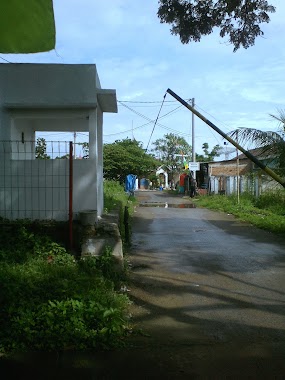
Local government office nearby Gerbang Blok H Baru
Coronavirus disease (COVID-19) Situation
confirmed cases
6829221
deaths
162063
Indonesia
Local government office nearby Gerbang Blok H Baru
Gerbang Blok H Baru
Unnamed Road, Sukaragam, Serang Baru, Bekasi, Jawa Barat 17330, Indonesia
contacts phone
:
+62
Latitude:
-6.3801326
, Longitude:
107.12051
larger map & directions
read more
nearest Local government office
395 m
POSYANDU Mawar XVII
Sukaragam
Local government office
read more
455 m
Perumahan Galindra
Jalan Mega Raya, Sukaragam
Local government office
read more
908 m
Prumhan Ci Benda
Jalan Raya Serang - Cibarusah No.17, Sukasari
Local government office
read more
2.774 km
Pondok Arraudhah 2
Pondok Arraudhah 2 RT01/01, Sukaragam
Local government office
read more
2.942 km
Perumahan TCI 3 blok A
Sukadami, Cikarang Selatan, Sukadami
Local government office
read more
3.001 km
Perum pesona Cijingga
Serang
Local government office
read more
3.418 km
Cijingga Permai
Serang
Local government office
read more
3.92 km
Perumahan Graha Ciantra Indah
Jalan Ciantra, Ciantra, Cikarang Selatan, Ciantra
Local government office
read more
4.104 km
perum alam sampurna indah
Kp.Pegadungan, Jayasampurna
Local government office
read more
4.396 km
Kantor BPJS Kesehatan Bekasi Kabupaten (KLO)
Ruko Metro Boulevard Blok B11, Jalan Niaga Raya, Cikarang Barat, Pasirsari, Sukadami
Local government office
read more
4.604 km
PASAR KAGET BLOK B
Vila Mutiara Cikarang No.1, Ciantra
Local government office
read more
5.024 km
Puri Persada Indah Blok U
Jalan Puri Persada Raya Sindangmulya, Sindangmulya
Local government office
read more
5.183 km
De Valley Cifest Hill
Jl. De Valley Cifest Hill, Ciantra
Local government office
read more
5.217 km
Pesona Bumi Asri
Jalan Gudang, Sindangmulya
Local government office
read more
5.333 km
Perumahan Bumi Sindang Asri Cibarusah
Jalan Gudang, Sindangmulya
Local government office
read more
13.312 km
Cluster JADE J18/15
Bekasi Timur Regency 3, Cluster Jade, Kelurahan Cimuning, Mustika Jaya, Cimuning
Local government office
read more
13.966 km
Kantor Desa Mekarsari
Jalan Raya Jonggol, Mekarsari
Local government office
read more
14.146 km
Perumahan mekarsari permai
Jalan Raya KH Umar Rawa Ilat, Gandoang
Local government office
read more
14.731 km
Balai Warga RW. 023 Perumahan Kirana Cibitung
Desa Wanajaya, Kec. Cibitung, Wanajaya
Local government office
read more
14.915 km
Housing Kirana Cibitung
Jalan Selang Jati, Wanajaya, Cibitung, Wanajaya
Local government office
read more
15.094 km
Graha Santika Mutiara Land
Jalan Kampung Bulak No.66, Mekarsari
Local government office
read more
16.05 km
PESONA JATIMULYA
Jalan Jampang No.143, Jatimulya
Local government office
read more
16.375 km
NIRWANA 2 RESIDENCE
Jalan Setia Mekar (Kampung Bulu), Setiamekar
Local government office
read more
16.399 km
Santunan Jaya
Jalan Wahana Bakti, Mangunjaya
Local government office
read more
17.562 km
Kantor Lurah Pengasinan
Jl. Mawar IV, Pengasinan, Rawalumbu, Pengasinan
Local government office
read more
📑
all categories
Accounting
Administrative area level 1
Administrative area level 2
Airport
Amusement park
Aquarium
Art gallery
Atm
Bakery
Bank
Bar
Beauty salon
Bicycle store
Book store
Bowling alley
Bus station
Cafe
Campground
Car dealer
Car rental
Car repair
Car wash
Casino
Cemetery
Church
City hall
Clothing store
Colloquial area
Convenience store
Courthouse
Dentist
Department store
Doctor
Electrician
Electronics store
Embassy
Finance
Fire station
Florist
Food
Funeral home
Furniture store
Gas station
General contractor
Grocery or supermarket
Gym
Hair care
Hardware store
Health
Hindu Temple
Home goods store
Hospital
Insurance agency
Intersection
Jewelry store
Laundry
Lawyer
Library
Liquor store
Local government office
Locality
Locksmith
Lodging
Meal delivery
Meal takeaway
Mosque
Movie rental
Movie theater
Moving company
Museum
Natural feature
Neighborhood
Night club
Painter
Park
Parking
Pet store
Pharmacy
Physiotherapist
Place of worship
Plumber
Point of interest
Police
Political
Post office
Premise
Real estate agency
Restaurant
Roofing contractor
Route
Rv park, camping
School
Shoe store
Shopping mall
Spa
Stadium
Storage
Store
Subpremise
Supermarket
Synagogue
Taxi stand
Train station
Transit station
Travel agency
University
Veterinary care
Zoo
administrative area level 3
administrative area level 4
administrative area level 5
sublocality level 1
↑