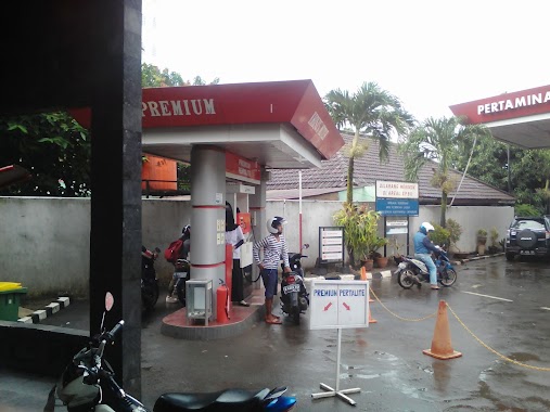
Gas station nearby SPBU
Indonesia
Gas station nearby SPBU
SPBU
64, Jalan Kelapa Dua Wetan V, 13730, Kota Jakarta Timur, Daerah Khusus Ibukota Jakarta, ID Indonesien
contacts phone
:
+62
Latitude:
-6.3451505
, Longitude:
106.8830201
larger map & directions
read more
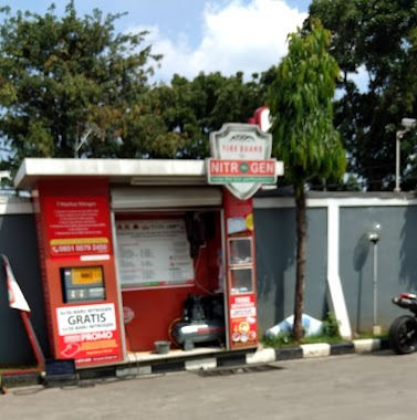
nearest Gas station
6 m
SPBU 34-13708
Jalan Raya Ciracas No.107, RT.4/RW.8, Kelapa Dua Wetan
Gas station
read more
737 m
Bengkel abadi motor
Jalan Raya Lapangan Tembak RT.1/RW.9, Cibubur
Gas station
read more
942 m
Promo Honda Cibubur
RT.7/RW.1, Cipayung
Gas station
read more
1.013 km
Pertamina
RT.7/RW.1, Cipayung
Gas station
read more
1.03 km
Pertamina gas station 34-13709
Jalan Raya Pkp No.1, RT.5/RW.12, Cibubur
Gas station
read more
1.036 km
Rest Area Pertamina gas station Cibubur
Jl Tol Jagorawi KM. 10 Jalur A, Munjul, Cipayung, RT.7/RW.1, Cipayung
Gas station
read more
1.285 km
Pom Mini Ugi
Jl. Buni, RT.1/RW.2, Munjul, Cipayung, RT.1/RW.2, Munjul
Gas station
read more
1.527 km
Eni Lubricant
Jalan Blok Duku No.1A, RT.8/RW.10, Cibubur
Gas station
read more
1.543 km
Pom Mini
Gang Naim RT.2/RW.13, Cibubur
Gas station
read more
1.579 km
Pertamina gas station Cipayung
Jalan Cipayung Raya No.31, RT.16/RW.1, Cipayung
Gas station
read more
1.629 km
Barokah Accu
Jalan Raya Cipayung No.66, RT.16/RW.1, Cipayung
Gas station
read more
1.675 km
Bensin Eceran Bang Peank
Jalan Harmed No.26, RT.9/RW.7, Pekayon
Gas station
read more
1.818 km
Pertamina gas station Ciracas
Jalan Ciracas Raya, RT.5/RW.11, Ciracas, RT.5/RW.6, Ciracas
Gas station
read more
2.031 km
SPBU VIVO Cilangkap
Jalan Raya Cilangkap No.16B, RT.2/RW.5, Cilangkap
Gas station
read more
2.041 km
Ovo Gas Station
Jalan Raya Cilangkap RT.2/RW.5, Cilangkap
Gas station
read more
2.041 km
Vivo Gas Station
Jalan Raya Cilangkap RT.2/RW.5, Cilangkap
Gas station
read more
2.15 km
Gaya Motor
Jl. Raya Bogor KM 26 No. 8 Ciracas Ciracas Jakarta Timur DKI Jakarta, RT.4/RW.8, Ciracas
Gas station
read more
2.176 km
Toko Bensin H. Sholeh
Jalan Drs.Haji.Th. Muhammad Gobel No.74, Mekarsari
Gas station
read more
2.347 km
Delima Berkah. CV
Jl Jambore, East Jakarta 13720, RT.6/RW.13, Cibubur
Gas station
read more
2.407 km
Pertamina gas station Al Ikhlas cibubur
Jalan Jambore No.8, RT.4/RW.14, Cibubur
Gas station
read more
2.468 km
ATM Mandiri
SPBU Pertamina, 54,612,40, Jalan Raya Bogor RT.1/RW.5, Pekayon
Gas station
read more
2.479 km
Bensin Pertamini
Indonesia
Gas station
read more
2.663 km
Pom Bensin ( SPBU Terpadu Jambore )
Jl.Jambore 1, Harjamukti, Cimanggis
Gas station
read more
3.241 km
SPBU Pertamina
Jalan Akses Baru Buperta KM. 1, Cibubur, Harjamukti, Cimanggis, Harjamukti
Gas station
read more
3.316 km
Pom KM 24
Jalan Raya Bogor KM.24 No.17, RT.3/RW.7, Susukan
Gas station
read more
📑
all categories
Accounting
Administrative area level 1
Administrative area level 2
Airport
Amusement park
Aquarium
Art gallery
Atm
Bakery
Bank
Bar
Beauty salon
Bicycle store
Book store
Bowling alley
Bus station
Cafe
Campground
Car dealer
Car rental
Car repair
Car wash
Casino
Cemetery
Church
City hall
Clothing store
Colloquial area
Convenience store
Courthouse
Dentist
Department store
Doctor
Electrician
Electronics store
Embassy
Finance
Fire station
Florist
Food
Funeral home
Furniture store
Gas station
General contractor
Grocery or supermarket
Gym
Hair care
Hardware store
Health
Hindu Temple
Home goods store
Hospital
Insurance agency
Intersection
Jewelry store
Laundry
Lawyer
Library
Liquor store
Local government office
Locality
Locksmith
Lodging
Meal delivery
Meal takeaway
Mosque
Movie rental
Movie theater
Moving company
Museum
Natural feature
Neighborhood
Night club
Painter
Park
Parking
Pet store
Pharmacy
Physiotherapist
Place of worship
Plumber
Point of interest
Police
Political
Post office
Premise
Real estate agency
Restaurant
Roofing contractor
Route
Rv park, camping
School
Shoe store
Shopping mall
Spa
Stadium
Storage
Store
Subpremise
Supermarket
Synagogue
Taxi stand
Train station
Transit station
Travel agency
University
Veterinary care
Zoo
administrative area level 3
administrative area level 4
administrative area level 5
sublocality level 1
↑