Cafe nearby Warung Bang Anda
Indonesia
Cafe nearby Warung Bang Anda
Warung Bang Anda
Sarakan Indonesien
contacts phone
:
+62
Latitude:
-6.1046882
, Longitude:
106.5883761
read more
nearest Cafe
52 m
Kantin Mama Aurel
Jalan Sultan Hasanudin, Sarakan
Cafe
read more
322 m
Dayung Junior Studio Musik
Jl.sultan hasanudin kampung pisangan rt 02 rw 01, Sarakan
Cafe
read more
617 m
Es Krim Goreng Dan Sop Duren
Jalan Raya Pakuhaji No.89, Kayu Agung
Cafe
read more
636 m
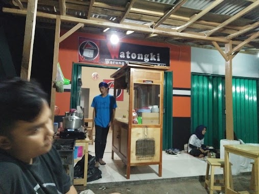
Watongki
Jalan Raya Pakuhaji No.1, Sarakan
Cafe
read more
705 m
warung baso mie ayam 22 mpo evi mamat
Sarakan
Cafe
read more
747 m
Cafe Noah 3
paku aji sepatan, Jalan Raya Pakuhaji, Pisangan Jaya
Cafe
read more
787 m
Nasi Uduk Rora
Perum Duta Asri Palm No.5, Sarakan
Cafe
read more
809 m
Blue Paint iik House
Jl.Ojasikong No Berapa, gitu
Cafe
read more
835 m
Cafe Noah
Gang Masjid Pisangan.Satu, Sarakan
Cafe
read more
907 m
Kedai Cihuy Paradise Park Sarakan
47, The Paradise Park Residence @ Sarakan Blok D, Sarakan
Cafe
read more
1.144 km
Cafe Roy
Bunisari
Cafe
read more
1.37 km
Ojek Online Grab Bike Periuk
Kayu Agung
Cafe
read more
1.54 km
Batagor Pisangan H.Unub
Kayu Agung
Cafe
read more
1.824 km
Komeng Cafe
Pondok Jaya
Cafe
read more
2.008 km
Bakso Tulen Aa
Sepatan Residen Blok M No 02, RW.03, Sepatan
Cafe
read more
2.008 km
Bakso Tulen Aa
Sepatan Residen Blok M No 02, RW.03
Cafe
read more
2.018 km
Kebab Buah
Jalan Raya Pakuhaji No.18, Sepatan
Cafe
read more
2.063 km
Cafeketsu91
Unnamed Road, Sepatan
Cafe
read more
2.086 km
Martabak Daffa
Sepatan
Cafe
read more
2.093 km
Pempek Palembang ABI Sepatan
Jalan Raya Mauk, Karet
Cafe
read more
2.127 km
trees vapor
Jalan Raya Mauk, Sepatan
Cafe
read more
2.171 km
warkop mia
Gang Veteran, Sepatan
Cafe
read more
2.341 km
Bubur Ayam Family
Jalan Gatot Subroto No.7, Jati Mulya
Cafe
read more
2.553 km
wr.pok ipat
Rawa Boni
Cafe
read more
2.576 km
Warung Kopi Bang Karim
kp kayu putih rt08/02desa, Rawa Boni
Cafe
read more
📑
all categories
Accounting
Administrative area level 1
Administrative area level 2
Airport
Amusement park
Aquarium
Art gallery
Atm
Bakery
Bank
Bar
Beauty salon
Bicycle store
Book store
Bowling alley
Bus station
Cafe
Campground
Car dealer
Car rental
Car repair
Car wash
Casino
Cemetery
Church
City hall
Clothing store
Colloquial area
Convenience store
Courthouse
Dentist
Department store
Doctor
Electrician
Electronics store
Embassy
Finance
Fire station
Florist
Food
Funeral home
Furniture store
Gas station
General contractor
Grocery or supermarket
Gym
Hair care
Hardware store
Health
Hindu Temple
Home goods store
Hospital
Insurance agency
Intersection
Jewelry store
Laundry
Lawyer
Library
Liquor store
Local government office
Locality
Locksmith
Lodging
Meal delivery
Meal takeaway
Mosque
Movie rental
Movie theater
Moving company
Museum
Natural feature
Neighborhood
Night club
Painter
Park
Parking
Pet store
Pharmacy
Physiotherapist
Place of worship
Plumber
Point of interest
Police
Political
Post office
Premise
Real estate agency
Restaurant
Roofing contractor
Route
Rv park, camping
School
Shoe store
Shopping mall
Spa
Stadium
Storage
Store
Subpremise
Supermarket
Synagogue
Taxi stand
Train station
Transit station
Travel agency
University
Veterinary care
Zoo
administrative area level 3
administrative area level 4
administrative area level 5
sublocality level 1
↑