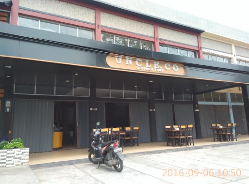
Cafe nearby WAROENG BANG BEWOK
Coronavirus disease (COVID-19) Situation
confirmed cases
6829221
deaths
162063
Indonesia
Cafe nearby WAROENG BANG BEWOK
WAROENG BANG BEWOK
Jalan T. Hasan Dek No.8, Kuta Alam Indonesia
contacts phone
:
+62
Latitude:
5.557111
, Longitude:
95.3302111
read more
nearest Cafe
10 m
Nasi Goreng DESEMBER JBTP
Jalan T. Hasan Dek, Beurawe
Cafe
read more
293 m
Malahayati Coffe
Jln. T. Daud Beureueh No. 132 Jambo Tape, Beurawe
Cafe
read more
322 m
Fly Coffee
Keuramat
Cafe
read more
324 m
Kulam Kafe
jl.teuku angkasa bendahara, Kuta Alam
Cafe
read more
338 m
Tongs Coffee Reborn
Jalan Teuku Muhammad Daud Beureueh, Laksana
Cafe
read more
372 m
Regina Kupi
Keuramat
Cafe
read more
382 m
Kopi Beurawe / Forsilakubra Forum Silaturahmi Kupi Beurawe
Beurawe
Cafe
read more
478 m
Gudang Ijo
Jalan Cut Makmun, Beurawe
Cafe
read more
484 m
Warkop Dahlan
Jalan Sentosa No.59, Keuramat
Cafe
read more
512 m
Moorden Coffee Shop
coffee, moorden, Beurawe
Cafe
read more
542 m
Beurawe Kopi
Beurawe
Cafe
read more
550 m
Aceh Bubur Ulee Kareng
Bandar Baru
Cafe
read more
552 m
Kantin Bg Adi Kaye Getanyoe Bersama.by Jack Sparrow
Lorong Metro, Beurawe
Cafe
read more
622 m
Dharma Kupi
Laksana
Cafe
read more
664 m
Galang Burger
Laksana
Cafe
read more
705 m
Bandrek Pak Sen
Ateuk Pahlawan
Cafe
read more
716 m
Warkop Pak Musa
Laksana
Cafe
read more
725 m
Ady Arabica Coffee
No. 50 a, Kp, Jalan Dharma, Laksana
Cafe
read more
804 m
Warkop Azhari
Jalan Bakti No.7, Laksana
Cafe
read more
947 m
Warkop Laris
Sp. Surabaya, Lamseupeung
Cafe
read more
975 m
Warkop Bak Mamplam
Jl. H. Zakaria, Lamseupeung, Lueng Bata, Lamseupeung
Cafe
read more
996 m
NN Cafe
Kuta Alam
Cafe
read more
1.081 km
Nasi Uduk Lamongan
Peuniti
Cafe
read more
1.213 km
Asrama TNI AD neusu Banda Aceh
Jalan TM Pahlawan, Peuniti
Cafe
read more
1.213 km
The Terminal Coffee
Peuniti
Cafe
read more
📑
all categories
Accounting
Administrative area level 1
Administrative area level 2
Airport
Amusement park
Aquarium
Art gallery
Atm
Bakery
Bank
Bar
Beauty salon
Bicycle store
Book store
Bowling alley
Bus station
Cafe
Campground
Car dealer
Car rental
Car repair
Car wash
Casino
Cemetery
Church
City hall
Clothing store
Colloquial area
Convenience store
Courthouse
Dentist
Department store
Doctor
Electrician
Electronics store
Embassy
Finance
Fire station
Florist
Food
Funeral home
Furniture store
Gas station
General contractor
Grocery or supermarket
Gym
Hair care
Hardware store
Health
Hindu Temple
Home goods store
Hospital
Insurance agency
Intersection
Jewelry store
Laundry
Lawyer
Library
Liquor store
Local government office
Locality
Locksmith
Lodging
Meal delivery
Meal takeaway
Mosque
Movie rental
Movie theater
Moving company
Museum
Natural feature
Neighborhood
Night club
Painter
Park
Parking
Pet store
Pharmacy
Physiotherapist
Place of worship
Plumber
Point of interest
Police
Political
Post office
Premise
Real estate agency
Restaurant
Roofing contractor
Route
Rv park, camping
School
Shoe store
Shopping mall
Spa
Stadium
Storage
Store
Subpremise
Supermarket
Synagogue
Taxi stand
Train station
Transit station
Travel agency
University
Veterinary care
Zoo
administrative area level 3
administrative area level 4
administrative area level 5
sublocality level 1
↑