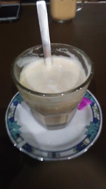
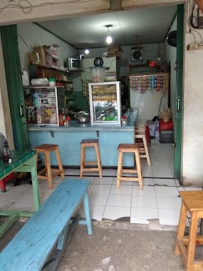
Cafe nearby WARKOP RIZKYA
Indonesia
Cafe nearby WARKOP RIZKYA
WARKOP RIZKYA
Jalan Bintara 17 No.24-28, Bintara Indonesia
contacts phone
:
+62
Latitude:
-6.2351878
, Longitude:
106.9591766
read more
nearest Cafe
288 m
Warkop HoAhHoEh
jl.kp.setu rt 011/02 no.1 17136, Bintara Jaya
Cafe
read more
412 m
warkop bintara 9
Bintara
Cafe
read more
474 m
iga bakar rajwa
Jalan Bintara Raya No.5, RT.05/RW.13, Bintara
Cafe
read more
485 m
Susu Jahe Putri Solo
Jalan Raya 15 (foodcourt), Bintara
Cafe
read more
487 m
Warung Bubur Kuningan
Jalan Bintara Raya No.91, Bintara
Cafe
read more
498 m
cafe & resto toedjoe-toedjoe 77
Blok Bintara 12 No., Jalan Raya Pondok Cipta Blok Bintara 12 No.17, Bintara
Cafe
read more
542 m
Mud Mud Thai Tea
Jalan Raya Pondok Cipta, Bintara
Cafe
read more
547 m
YakaliCafe
Jalan Raya Pondok Cipta Blok A2 No.18, Bintara
Cafe
read more
646 m
MARTABOX MIYABI
Jl. Bintara Raya No.39, Bintara, Kota Bks
Cafe
read more
670 m
Es Doger
Jalan Patriot, Jakasampurna
Cafe
read more
689 m
Barbershop Mister Cukur
Jalan Raya Kampung Setu, Bintara Jaya
Cafe
read more
759 m
Andian Home Stay
Blok Nurul Iman 8, Jalan Nurul Iman Raya Blok Nurul Iman 8 No.33, Jakasampurna
Cafe
read more
790 m
Moo Nyusu Pondok Cipta
Bintara
Cafe
read more
805 m
BASECAMP ANCHAM KONOHA
Bintara
Cafe
read more
818 m
Empang Bang Omat
Jalan Al-Ikhlas, Jakasampurna
Cafe
read more
896 m
Warkop Sederhana
Bintara
Cafe
read more
901 m
RBI
Bintara
Cafe
read more
923 m
Warung Bambu
Jakasampurna
Cafe
read more
932 m
Warung Tempo 90an
Jl. Bintara Raya, Bintara, Bar., Kota Bks, 1,2 km, Bintara
Cafe
read more
1.073 km
komplek pinggir tol bintara
Bintara
Cafe
read more
1.099 km
Warsen Kuyy
Bintara Jaya
Cafe
read more
1.106 km
Warung Es Kelapa Muda
Jalan Assyafiiyah No.2, Jakasampurna
Cafe
read more
1.112 km
Komplek Bang Ucup
Bintara
Cafe
read more
1.152 km
Renny Pop Ice
30, Jalan Bintara I, Bintara
Cafe
read more
1.324 km
Soto Marem Kranji
Jalan Assyafiiyah No.20-3, Jakasampurna
Cafe
read more
📑
all categories
Accounting
Administrative area level 1
Administrative area level 2
Airport
Amusement park
Aquarium
Art gallery
Atm
Bakery
Bank
Bar
Beauty salon
Bicycle store
Book store
Bowling alley
Bus station
Cafe
Campground
Car dealer
Car rental
Car repair
Car wash
Casino
Cemetery
Church
City hall
Clothing store
Colloquial area
Convenience store
Courthouse
Dentist
Department store
Doctor
Electrician
Electronics store
Embassy
Finance
Fire station
Florist
Food
Funeral home
Furniture store
Gas station
General contractor
Grocery or supermarket
Gym
Hair care
Hardware store
Health
Hindu Temple
Home goods store
Hospital
Insurance agency
Intersection
Jewelry store
Laundry
Lawyer
Library
Liquor store
Local government office
Locality
Locksmith
Lodging
Meal delivery
Meal takeaway
Mosque
Movie rental
Movie theater
Moving company
Museum
Natural feature
Neighborhood
Night club
Painter
Park
Parking
Pet store
Pharmacy
Physiotherapist
Place of worship
Plumber
Point of interest
Police
Political
Post office
Premise
Real estate agency
Restaurant
Roofing contractor
Route
Rv park, camping
School
Shoe store
Shopping mall
Spa
Stadium
Storage
Store
Subpremise
Supermarket
Synagogue
Taxi stand
Train station
Transit station
Travel agency
University
Veterinary care
Zoo
administrative area level 3
administrative area level 4
administrative area level 5
sublocality level 1
↑