Cafe nearby Warkop Delima
Coronavirus disease (COVID-19) Situation
confirmed cases
6829221
deaths
162063
Indonesia
Cafe nearby Warkop Delima
Warkop Delima
3, Jalan Jaksa, 10340, Kota Jakarta Pusat, Daerah Khusus Ibukota Jakarta, ID Indonesia
contacts phone
:
+62
Latitude:
-6.1835536
, Longitude:
106.8296825
larger map & directions
read more
nearest Cafe
146 m
New Memories Cafe
JL Jaksa 17 Central Jakarta, RT.8/RW.5, Kebon Sirih
Cafe
read more
244 m
ERNI Cafe
Jalan Kebon Sirih Barat Gang 14 No.31 Menteng Kota Jakarta Pusat, Daerah Khusus Ibukota Jakarta 10340, RT.4/RW.4, Kebon Sirih
Cafe
read more
449 m
Cyber Cafe
Jalan Jaksa No.27, RT.3/RW.3, Kebon Sirih, Menteng
Cafe
read more
462 m
Al Jazeerah Signature Restaurant & Lounge
Jalan Johar No.8, RT.18/RW.6, Kebon Sirih
Cafe
read more
464 m
ABSOLUTE CAFÉ
Jalan Jaksa No.5, RT.3/RW.1, Kebon Sirih
Cafe
read more
529 m
Ayam Goreng Sambal Raden Menteng 7
Jalan HOS. Cokroaminoto No.7, RT.1/RW.3, Menteng
Cafe
read more
639 m
Soto Betawi Sabar Menunggu
RT.5/RW.2, Gambir
Cafe
read more
641 m
Kedai Kopi Singgalang
Jalan Medan Merdeka Timur No.13, RT.5/RW.2, Gambir
Cafe
read more
674 m
KOFFIERASSE WISMA MANDIRI
M.H., Jalan K.H. Wahid Hasyim No.5, RT.2/RW.1, Kebon Sirih
Cafe
read more
705 m
Kafe Mas Jagur
RT.6/RW.1, Gambir
Cafe
read more
764 m
Starbucks Skyline
Djakarta Theater (Skyline) Lantai GF, Jalan M.H. Thamrin No. 9, Kebon Sirih, Menteng, RT.2/RW.1, RT.2/RW.1, Kebon Sirih
Cafe
read more
774 m
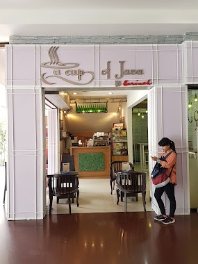
A Cup of Java
Sarinah No. 11 , Lantai Ground, Jalan M.H. Thamrin RT.8/RW.4, Gondangdia
Cafe
read more
778 m
Jeruk Baper Sarinah
M.H., Jalan KH. Wahid Hasyim No.11, RT.7/RW.5, Gondangdia
Cafe
read more
782 m
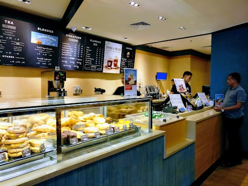
Caribou Coffee Sarinah
Jalan M.H. Thamrin No.11, RT.8/RW.4, Menteng
Cafe
read more
788 m
Bugis Kopitiam
Stasiun Gambir, Jalan Medan Merdeka Timur No. 1, Gambir, RT.5/RW.2, Gambir
Cafe
read more
807 m
Warung Mang Zanir
Jalan Gondangdia Dalam No.9, RT.2/RW.5, Cikini
Cafe
read more
823 m
Techo Cafe BPPT
RT.10/RW.10, Kampung Bali
Cafe
read more
827 m
My Cha
Sarinah No. 11 , Lantai Ground, Jalan M.H. Thamrin RT.8/RW.4, Gondangdia
Cafe
read more
887 m
Starbucks Menteng Huis
Menteng Huis Lt. Dasar, Jalan Cikini Raya No.2-4, RT.13/RW.5, Cikini, Menteng, RT.13/RW.5, Cikini
Cafe
read more
937 m
Tenda Oren Menara Thamrin
Jalan Kampung Bali XXXIII No.57, RT.10/RW.10, Kampung Bali
Cafe
read more
951 m
The Coffee Bean
Plaza BII Tower III, Jalan M.H. Thamrin, Menteng, RT.9/RW.4, Gondangdia
Cafe
read more
958 m
Exquise Patisserie
Rumah Cokro, Jalan HOS. Cokroaminoto No.42A, RW.4, Gondangdia
Cafe
read more
1.04 km
Ropita Aneka Rasa CIKINI
Jalan Cikini Raya No.55A, RT.16/RW.1, Cikini
Cafe
read more
1.212 km
Jojo Aulia Deprok Kopi
Jalan Cikini Raya No.69A, Cikini
Cafe
read more
1.258 km
Kopikul
Jalan Cikini V No.8, RT.11/RW.5, Cikini
Cafe
read more
📑
all categories
Accounting
Administrative area level 1
Administrative area level 2
Airport
Amusement park
Aquarium
Art gallery
Atm
Bakery
Bank
Bar
Beauty salon
Bicycle store
Book store
Bowling alley
Bus station
Cafe
Campground
Car dealer
Car rental
Car repair
Car wash
Casino
Cemetery
Church
City hall
Clothing store
Colloquial area
Convenience store
Courthouse
Dentist
Department store
Doctor
Electrician
Electronics store
Embassy
Finance
Fire station
Florist
Food
Funeral home
Furniture store
Gas station
General contractor
Grocery or supermarket
Gym
Hair care
Hardware store
Health
Hindu Temple
Home goods store
Hospital
Insurance agency
Intersection
Jewelry store
Laundry
Lawyer
Library
Liquor store
Local government office
Locality
Locksmith
Lodging
Meal delivery
Meal takeaway
Mosque
Movie rental
Movie theater
Moving company
Museum
Natural feature
Neighborhood
Night club
Painter
Park
Parking
Pet store
Pharmacy
Physiotherapist
Place of worship
Plumber
Point of interest
Police
Political
Post office
Premise
Real estate agency
Restaurant
Roofing contractor
Route
Rv park, camping
School
Shoe store
Shopping mall
Spa
Stadium
Storage
Store
Subpremise
Supermarket
Synagogue
Taxi stand
Train station
Transit station
Travel agency
University
Veterinary care
Zoo
administrative area level 3
administrative area level 4
administrative area level 5
sublocality level 1
↑