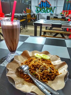
Cafe nearby Mokko Factory Donut & Coffe
Coronavirus disease (COVID-19) Situation
confirmed cases
6829221
deaths
162063
Indonesia
Cafe nearby Mokko Factory Donut & Coffe
Mokko Factory Donut & Coffe
city center, Passo Indonesia
contacts phone
:
+62
Latitude:
-3.6320029
, Longitude:
128.249524
read more
nearest Cafe
38 m
Maxx Coffee
Passo
Cafe
read more
2.192 km
Delta Coffe
Jalan Laksdya Leo Wattimena, Nania
Cafe
read more
2.89 km
Suratno Kaluku Resident + Office
Waiheru
Cafe
read more
3.82 km
Warung Rasa Sayang
Halong
Cafe
read more
3.822 km
Warung Bakso Solo
Halong
Cafe
read more
5.28 km
POPEYE09 Cafe
PUSKOPAL ARMATIM, Halong
Cafe
read more
6.001 km
Cafe Bakudapa
Halong
Cafe
read more
6.261 km
Kedai Coffee Meeeooong
Jalan Y. Syaranamual, Batu Koeneng
Cafe
read more
7.038 km
Pop Ice Oma Sien
Rumah Tiga
Cafe
read more
7.049 km
Oei Cafe
Jalan Jenderal Sudirman, Batu Merah
Cafe
read more
7.075 km
Kacupeng Snack Corner
Maluku City Mall (Mcm) Parkiran Food Court, Hative Kecil
Cafe
read more
7.083 km
J.CO Ambon City Center
MCM, Hative Kecil
Cafe
read more
7.101 km
Calais Cafe MCM
Hative Kecil
Cafe
read more
7.102 km
Cuppa Coffee
Hative Kecil
Cafe
read more
8.145 km
Eve Corner
Pandan Kasturi
Cafe
read more
8.383 km
Keday GHAZYA
Jalan Ir. Muhammad Putuhena, Rumah Tiga
Cafe
read more
9.289 km
Metro Warnet
Kel Amantelu
Cafe
read more
9.601 km
Walang Kopi Papaceda & Bread F
Jalan Kopi No.5, Waiyame
Cafe
read more
9.809 km
Kedai Kopi 86
Kel Rijali
Cafe
read more
9.848 km
Positive Kafe kayu 3
Komp bethabara Kayu No.3, Soya
Cafe
read more
10.269 km
Cafe Bakudapa
Uritetu
Cafe
read more
10.322 km
Warung Kopi Kaki Gunung
Kel Batu Meja
Cafe
read more
10.496 km
Kedai Kopi "Joas Original"
Unnamed Road, Kel Honipopu
Cafe
read more
10.529 km
Toko Kue New Cinderella
Doktor Setiabudi, Kel Ahusen
Cafe
read more
10.546 km
Kafe Cangkir
Kel Ahusen
Cafe
read more
📑
all categories
Accounting
Administrative area level 1
Administrative area level 2
Airport
Amusement park
Aquarium
Art gallery
Atm
Bakery
Bank
Bar
Beauty salon
Bicycle store
Book store
Bowling alley
Bus station
Cafe
Campground
Car dealer
Car rental
Car repair
Car wash
Casino
Cemetery
Church
City hall
Clothing store
Colloquial area
Convenience store
Courthouse
Dentist
Department store
Doctor
Electrician
Electronics store
Embassy
Finance
Fire station
Florist
Food
Funeral home
Furniture store
Gas station
General contractor
Grocery or supermarket
Gym
Hair care
Hardware store
Health
Hindu Temple
Home goods store
Hospital
Insurance agency
Intersection
Jewelry store
Laundry
Lawyer
Library
Liquor store
Local government office
Locality
Locksmith
Lodging
Meal delivery
Meal takeaway
Mosque
Movie rental
Movie theater
Moving company
Museum
Natural feature
Neighborhood
Night club
Painter
Park
Parking
Pet store
Pharmacy
Physiotherapist
Place of worship
Plumber
Point of interest
Police
Political
Post office
Premise
Real estate agency
Restaurant
Roofing contractor
Route
Rv park, camping
School
Shoe store
Shopping mall
Spa
Stadium
Storage
Store
Subpremise
Supermarket
Synagogue
Taxi stand
Train station
Transit station
Travel agency
University
Veterinary care
Zoo
administrative area level 3
administrative area level 4
administrative area level 5
sublocality level 1
↑