Cafe nearby Dapur Si Princess
Indonesia
Cafe nearby Dapur Si Princess
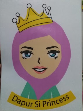
Dapur Si Princess
28, Jalan Parkit I, 16515, Depok City, West Java, ID Indonesia
contacts phone
:
+62 812-1015-5526
website:
www.instagram.com
Latitude:
-6.3586581
, Longitude:
106.7790135
larger map & directions
read more
nearest Cafe
279 m
2madison Design House
Promenade 20, jalan Bangka Raya no.20 Kemang, Limo
Cafe
read more
286 m
Warkop Bumi Ayu
Jalan Garuda Ujung #162A Cinere Limo, Limo
Cafe
read more
311 m
Wardi Niken
Cafe
read more
313 m
Warkop Nandah
Jalan Garuda Ujung, Limo
Cafe
read more
389 m
Warkop Nongkrong Kalangan Remaja Indonesia
Limo
Cafe
read more
389 m
Warkop Nongkrong Kalangan Remaja Indonesia
Indonesia
Cafe
read more
437 m
Es Kepal Milo Yasmine
Jalan Sasak Raya, Limo
Cafe
read more
484 m
Dippylicious
Jalan Limo Raya RT 03 RW 05 #86 Limo, Limo
Cafe
read more
487 m
Grand Cinere C7
Jalan Pinang Dua, Limo
Cafe
read more
579 m
Warkop Big's Family
Depan SPBU Jalan limo Raya RT 01 RW02 #21 Limo, Limo
Cafe
read more
592 m
B.C. Wisma Cakra
Cakra Sakti, Limo
Cafe
read more
597 m
Warung Kopi
Limo
Cafe
read more
633 m
Warpool (Waroeng Ngoempool)
Jalan Limo Raya No.23, Limo
Cafe
read more
659 m
Rockace
Jalan Limo Raya No.28, Limo
Cafe
read more
674 m
Warung Pintar Limo Raya 1
Limo
Cafe
read more
674 m
Warung Pintar Bojongsari 2
Jalan Limo Raya No.44-18, Limo
Cafe
read more
754 m
Warkop Baraya
Jalan Limo Raya No.26b, Limo
Cafe
read more
754 m
Warkop Baraya
Limo
Cafe
read more
762 m
Warkop Pangkalan 25
Jalan Limo Raya No.5, Limo
Cafe
read more
812 m
Warkop Berkah
Jalan Rawa Jati RT.04 / RW. 08, Limo
Cafe
read more
867 m
NasdukFikri
Limo
Cafe
read more
928 m
Ojek Online Warkop Team
Limo
Cafe
read more
998 m
Es'Gambreng
Jalan H. Asinun, Limo
Cafe
read more
1.002 km
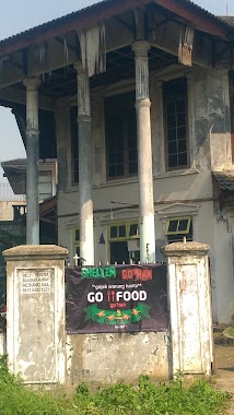
Shelter Go'han
Cafe
read more
1.151 km
somay biskun
Jalan Cakra Budaya No.8, Grogol
Cafe
read more
📑
all categories
Accounting
Administrative area level 1
Administrative area level 2
Airport
Amusement park
Aquarium
Art gallery
Atm
Bakery
Bank
Bar
Beauty salon
Bicycle store
Book store
Bowling alley
Bus station
Cafe
Campground
Car dealer
Car rental
Car repair
Car wash
Casino
Cemetery
Church
City hall
Clothing store
Colloquial area
Convenience store
Courthouse
Dentist
Department store
Doctor
Electrician
Electronics store
Embassy
Finance
Fire station
Florist
Food
Funeral home
Furniture store
Gas station
General contractor
Grocery or supermarket
Gym
Hair care
Hardware store
Health
Hindu Temple
Home goods store
Hospital
Insurance agency
Intersection
Jewelry store
Laundry
Lawyer
Library
Liquor store
Local government office
Locality
Locksmith
Lodging
Meal delivery
Meal takeaway
Mosque
Movie rental
Movie theater
Moving company
Museum
Natural feature
Neighborhood
Night club
Painter
Park
Parking
Pet store
Pharmacy
Physiotherapist
Place of worship
Plumber
Point of interest
Police
Political
Post office
Premise
Real estate agency
Restaurant
Roofing contractor
Route
Rv park, camping
School
Shoe store
Shopping mall
Spa
Stadium
Storage
Store
Subpremise
Supermarket
Synagogue
Taxi stand
Train station
Transit station
Travel agency
University
Veterinary care
Zoo
administrative area level 3
administrative area level 4
administrative area level 5
sublocality level 1
↑