IndonesiaBekasi
Bekasi
Administrative Region:
West Java
population:
3 510 676
calling code:
+62-21
postcode:
171xx-176xx
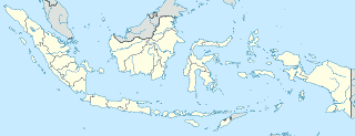
Location on the map of Indonesia
Bekasi
Park


Real estate agency
PENJUALAN MODIFIKASI CONTAINNER
Jl Marunda makmur depan pantai moderen,gudang no 91 Segara makmur, Jalan Taruma Jaya, Pusaka Rakyat
Marketing Office Villa d'Ivoire Hope
Jalan Raya Kaliabang Tengah No.2, Kaliabang Tengah, Bekasi Utara
CV Lia Jaya Mandiri 2
Jl Karang Satria - Rawa Kalong RT 05 RW 05 Tambun Utara, Karangsatria
Perum Auri Bumi Dirgantar Permai
JL.iswahyudi Blok BF No.20, Jatisari, Jatiasih, Jatisari
Kantor Marketing Galeri Claster Syariah Klari Islamic Residence Karawang
Jalan Surotokunto, Adiarsa Timur
Kantor Pemasaran Pratama Indah
Jalan Raya Teluk Pucung Bahagia Blok DD38 No.5, Teluk Pucung
Thata Prakarsa Nusa
Kp Rawa Hingkik RT 001%2FRW 04 Cikahuripan Cileungsi Bogor Jawa Barat, Mekarsari
Properti Syariah
Jl Bintara Jaya no 14 rt/rw 02/09 Bintara Jaya Bekasi Barat, Bintara Jaya
Rumah Oxy
Jl. Swadaya II No. 84 Rt. 05/08 Jatimakmur, Pondok Gede, Bekasi, Jatimakmur
Basecamp DPD PSI Kab. Karawang - Jawa Barat
Jalan Baru Tanjung Pura, Tanjungmekar
Restaurant

Bakso Lapangan Tembak Senayan
Mall Summarecon Bekasi Lantai 3 Jalan Bulevar Ahmad Yani, Marga Mulya, Bekasi Utara, Marga Mulya

Soto boyolali Mbok Lasiyem
blok D 9 no., Jalan Pondok Ungu Permai Blok D11 No.17, Kaliabang Tengah


Ayam Penyet Barokah
Jalan Bekasi Timur Regency Blok J 2 # 1 , Burangkeng , Setu, Bekasi, Burangkeng


Synagogue
Car dealer

Samudera Intan Motor
Pusat Otomotif Sentra Harapan Blok G No 9 Medan Satria, Jalan Harapan Indah, Medan Satria
Gema Mobilindo
Ruko Sentra Bisnis, Jalan Harapan Indah Raya Blok B No.8, Medan Satria
Star Mobil 1
No 31, Jalan Ruko Onderdil Blok ED Pejuang Medan Satria Bekasi Vestjava 17131 ID, Jalan Harapan Indah Raya
CINDY MOTOR
Jalan Ruko Onderdil Harapan Indah Blok EC No 23 Medan Satria, Pejuang

Mitsubishi Bekasi, Tambun, Cibitung, Pajero, Xpander, L300, T120SS, Colt Diesel, Fuso
Suncity Square, Jl. M. Hasibuan, Ruko, Marga Jaya
PICK-UP SUZUKI Tanya Promo, Harga & Paket Kredit
Jalan Sultan Agung Km. 24 Harapan Indah, Medan Satria
📑 Bekasi all categories
AccountingAdministrative area level 2AirportAmusement parkAquariumArt galleryAtmBakeryBankBarBeauty salonBicycle storeBook storeBus stationCafeCampgroundCar dealerCar rentalCar repairCar washCasinoCemeteryChurchCity hallClothing storeConvenience storeCourthouseDentistDepartment storeDoctorElectricianElectronics storeFinanceFire stationFloristFoodFuneral homeFurniture storeGas stationGeneral contractorGrocery or supermarketGymHair careHardware storeHealthHindu TempleHome goods storeHospitalInsurance agencyJewelry storeLaundryLawyerLibraryLiquor storeLocal government officeLocalityLocksmithLodgingMeal deliveryMeal takeawayMosqueMovie rentalMovie theaterMoving companyMuseumNatural featureNeighborhoodNight clubPainterParkParkingPet storePharmacyPhysiotherapistPlace of worshipPlumberPoint of interestPolicePost officePremiseReal estate agencyRestaurantRoofing contractorRouteRv park, campingSchoolShoe storeShopping mallSpaStadiumStorageStoreSubpremiseSupermarketSynagogueTaxi standTrain stationTransit stationTravel agencyUniversityVeterinary careZooadministrative area level 3administrative area level 4